Active Weather This Weekend, Including Severe Storm Chances
A chilly day is ahead before storm chances return for part of the weekend.Friday, February 24th 2023, 7:24 am
If you’re into podcasts or in a rush, check out my daily weather update. Search for NewsOn6 and ‘Weather Out The Door’ on most podcast providers, including Spotify, Stitcher and Tune-In, or Click Here to listen on Apple Podcasts.
TULSA, Okla. - A chilly day is ahead before storm chances return for part of the weekend.
Here are the details from News On 6 Meteorologist Alan Crone:

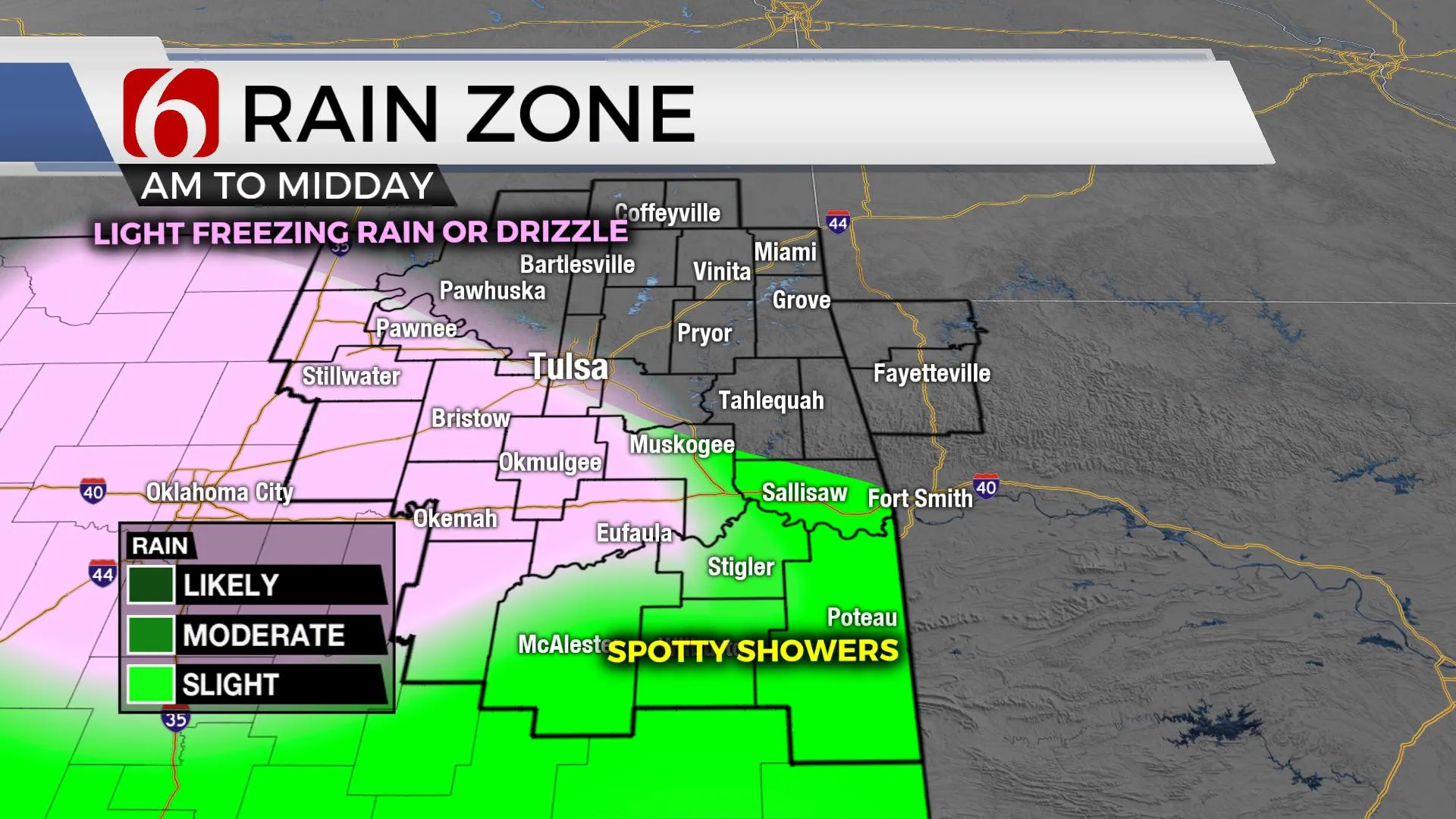
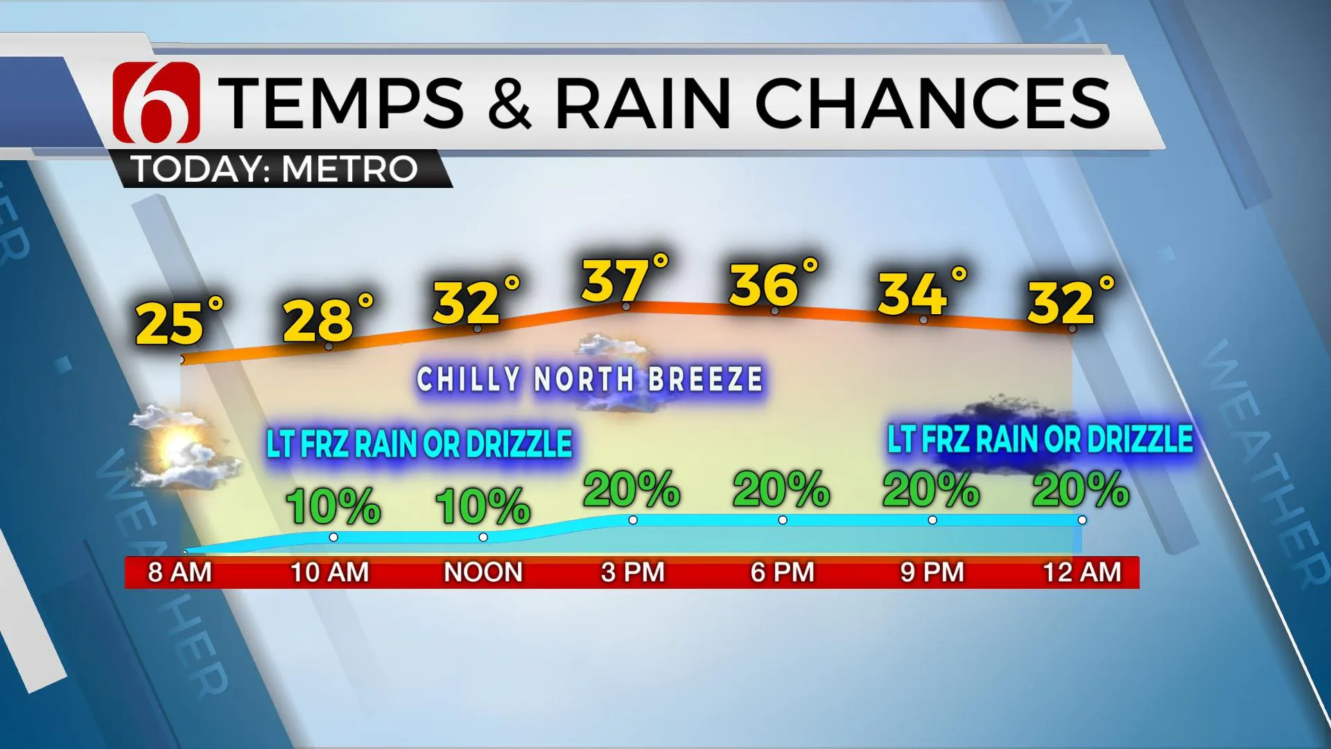
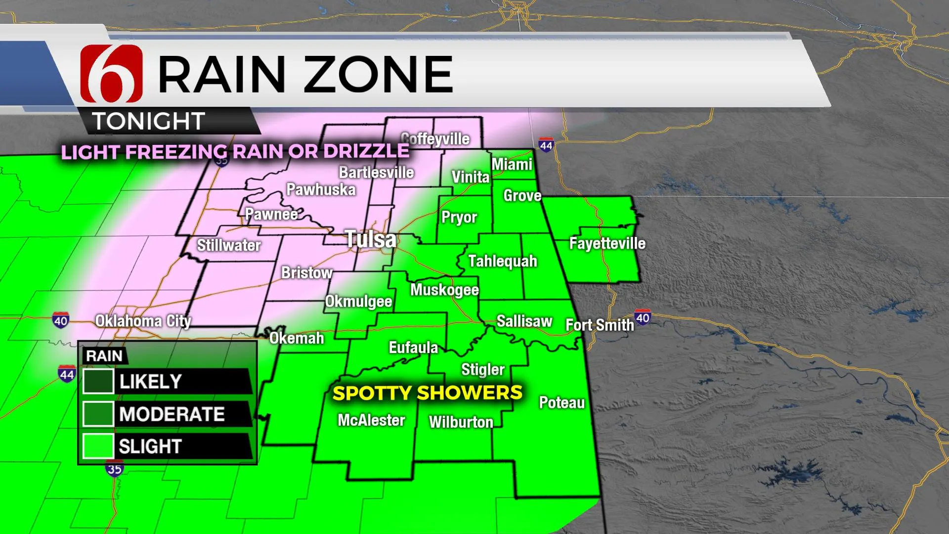
A powerful upper-level system west of the region will begin to influence our area soon. Shallow cold air will remain at the surface as relatively warm and moist air begins moving up and over this air mass on Friday and Saturday. This results in scattered showers, including Friday morning through midday across southern OK and later Friday night across the northern sections of the state. Temperatures will remain below freezing Friday morning through noon near and west of the Tulsa metro, while locations south and east should climb into the 40s. A window will exist this morning for pockets of freezing drizzle or even light freezing rain southwest or west of the Tulsa metro. I will carry a low probability for freezing drizzle near the Tulsa metro midday. Many locations will remain dry, so probabilities will remain low. But some areas will see light, yet measurable precipitation today and tonight. Temperatures this evening will briefly drop near or below freezing along and northwest of I-44, where any drizzle or light showers would cause slick spots on elevated surfaces. Please remain aware if local travel advisories are posted.

Slightly higher coverage is expected Saturday afternoon and evening that may blossom early Sunday morning. Afternoon highs should reach the upper 40s and lower 50s Saturday and upper 60S Sunday. The highest chance of showers and thunderstorms will arrive Sunday evening as the powerful upper-level system draws near the central plains. Severe weather parameters suggest the potential for severe storms. Low-level moisture will be streaming into the area by Sunday evening as strong winds aloft approach the state. A mitigating factor will be the time of passage late Sunday evening into pre-dawn Monday that could limit surface instabilities. Regardless, we'll continue to highlight the potential for all modes of severe threats. This means hail, wind, and tornadoes will be possible with the main threat of damaging winds. As the system exits early Monday morning, pleasant weather will persist for a few days next week with afternoon highs reaching the upper 60s and lower 70s. Another strong system may be near the state by the latter half of next week.

Thanks for reading the Friday morning weather discussion and blog.
Have a super great day. Please remain aware of your weather surroundings today and again Sunday evening as severe weather threats arrive.
Alan Crone
KOTV
More Like This
February 24th, 2023
July 3rd, 2023
June 8th, 2023
June 6th, 2023
Top Headlines
December 14th, 2024
December 14th, 2024
December 14th, 2024


