Pleasant Saturday Weather But Warming Trend On The Way
<p>We’re kicking off the weekend with another pleasant fall day here in Green Country! Enjoy it if you’re a fall weather fan, because a summer-like warm-up is on the way.</p>Saturday, September 29th 2018, 8:49 am
We’re kicking off the weekend with another pleasant fall day here in Green Country! Enjoy it if you’re a fall weather fan, because a summer-like warm-up is on the way.
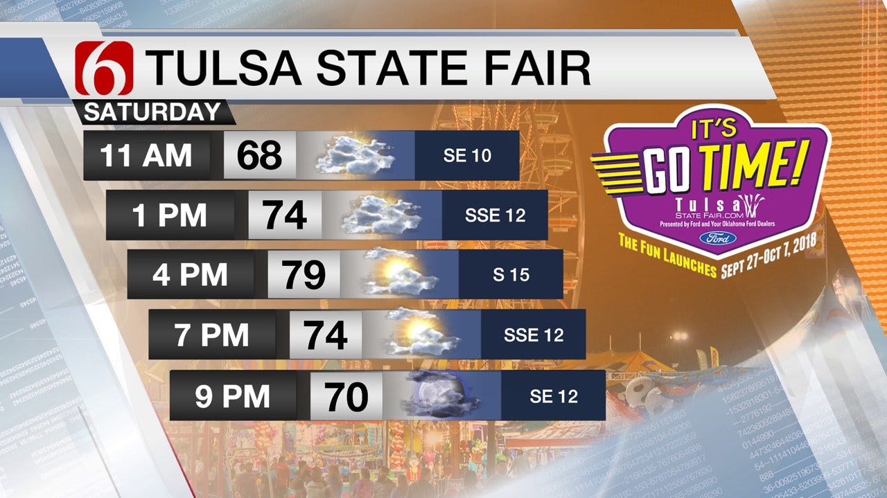
Clouds will linger for the first half of our Saturday with mostly cloudy skies prevailing for the morning. More sunshine will break out for the afternoon hours, and temperatures again look pleasant and seasonable for our Saturday, with highs generally in the upper 70s today! The one exception will be for areas northwest of Tulsa, where clouds will linger the longest and potentially hold highs in the mid-70s there.
A warmer and more humid weather pattern starts to set up on Sunday as we have our first of several straight days with a steady south wind. Once again, we’ll have morning clouds on Sunday followed by afternoon sunshine, with highs in the lower 80s to wrap up the weekend.
And the temperature trend only goes up from there! It’s back to t-shirt weather this upcoming work week. Temperatures will be several degrees above normal as we see highs surge into the mid-80s Monday afternoon and a gusty south wind. Expect the warming trend to continue into mid-week with highs in the mid-80s on Tuesday, the upper 80s on Wednesday, and some spots getting close to 90 degrees by Thursday!
The weather pattern looks to turn more active by the end of the upcoming week as an upper level trough deepens off to our west. As this happens, a slow-moving cold front will sag into Green Country, providing a focal point for a few scattered showers and storms on Friday. Storm chances are looking higher next weekend as that front potentially stalls out across eastern Oklahoma. We’ll keep you advised as things become more clear!
Have a wonderful Saturday, Green Country! Be sure to follow me on Twitter @StephenNehrenz as well as my Facebook page Meteorologist Stephen Nehrenz to stay up to date with the very latest!
More Like This
September 29th, 2018
September 29th, 2024
September 17th, 2024
Top Headlines
December 11th, 2024
December 11th, 2024
December 11th, 2024


