Record High Temperatures Before Cooler Weather Returns To Northeastern Oklahoma
After some unseasonably warm weather today, another cold front arrives tonight with a chance for a couple of isolated storms followed by another cool-down Thursday and Friday.Wednesday, April 8th 2020, 2:31 am
After some unseasonably warm weather today, another cold front arrives tonight with a chance for a couple of isolated storms followed by another cool-down Thursday and Friday. A stronger upper level system nears the state this weekend with increasing rain and thunder chances for some sections before a winter-like cold front rolls across the state Sunday afternoon sending temperatures plummeting into the 30s and 40s by Monday morning. The overall upper air pattern for most of next week also depicts well below seasonal average temperatures with a potential for a light freeze or frost Tuesday morning in some valley locations of Northeastern OK. Another strong front may also arrive by the middle of next week keeping reminding us more of February weather than mid-April. We may see a brief warm-up into next weekend before another pattern change occurs bringing more chilly air into the nation next week.

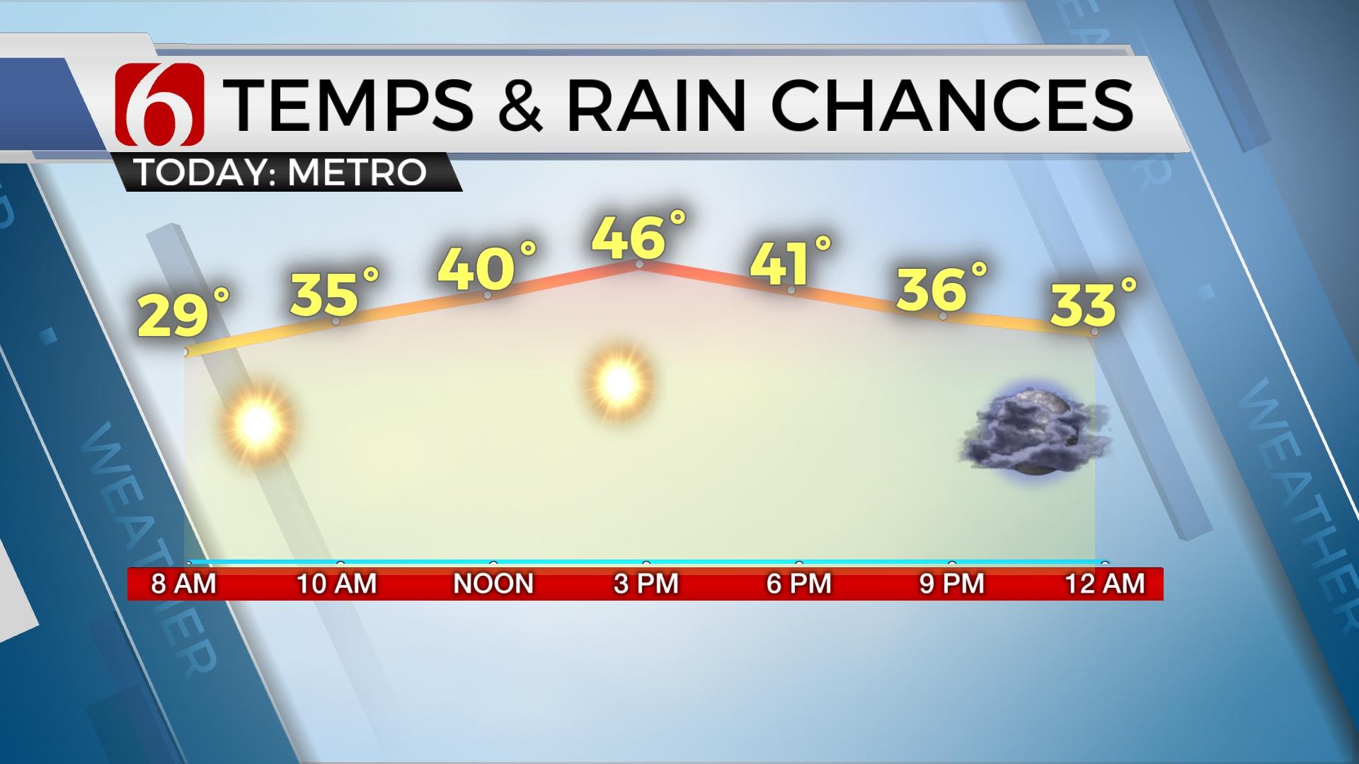
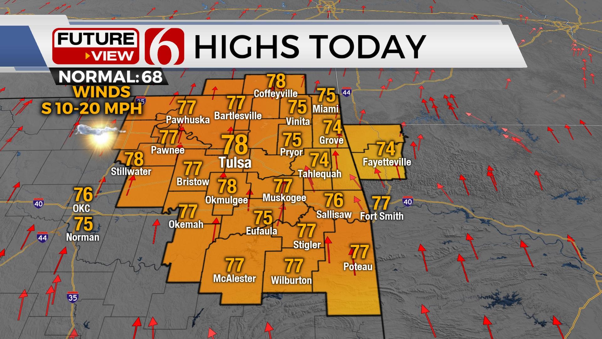
A weak pre-frontal trough has briefly made an appearance in northern OK this morning with a northeast wind and temps mostly in the 50s outside of the immediate Tulsa metro. South winds should quickly return as our next upper level wave moves across the central plains and pressure begins to fall to our northwest. Highs this afternoon are again expected to reach the mid-80s with some locations nearing daily maximum record highs. Some of the hi-res model sets are quickly mixing down the dew points this afternoon before the front arrives and this has resulted in model temps nearing the lower and mid-90s. We’ll not take the bait on the actual output, but this scenario is not impossible. Based on yesterday’s temps, I’ll continue to stay on the high side today with afternoon readings nearing 90 for Tulsa.

A cold front will near the northern OK state line region between 5pm and 8pm and will continue moving rapidly southeast through the evening hours. A layer of warm air aloft (the CAP) is likely to suppress most upward vertical development along and ahead of the boundary which will limit any surface-based thunderstorm activity in our area. A few cells may breach this inversion and develop slightly post-frontal across far northeastern OK and northwestern Arkansas. One or two of these may be strong to severe with hail and damaging winds the primary threats. I still think it’s prudent to keep a mention for a storm in the forecast even with such low probabilities. I would rather make errors by informing you beforehand and not afterward, but most data suppress any storm activity in our area this afternoon and evening.

This cold front will bring a difference in airmass and temperature Thursday and Friday with morning lows in the metro dropping to the lower 40s and highs in the 60s. Thursday has the potential to be a very nice 5-star weather day along as the humidity values in the 850 layer remains low and we get some decent sunshine. Friday morning may start in the upper 30s in some valley locations before south winds return in advance of our next stronger looking storm system. A surface ridge of high pressure should remain nearby for most of the day with highs staying in the lower 60s along with some sunshine.
The system for the weekend remains mostly across the Baja this morning but will continue to advance inland, across part of the southwestern U.S. and eject somewhere across the southern plains Saturday night into Sunday. This is a robust and strong upper system that could provide severe weather threats for the state depending upon exact trajectory and the surface reflection. As of this morning, most data continue suggesting the main severe weather parameters will stay south of the Red River, mostly across Texas. But we’re getting some hints that this may nudge northward Saturday evening into Sunday morning. I must stress a slower system, such as depicted at times in the EURO data, could bring a few strong to severe storms across southeastern or extreme east central OK. The GFS is faster and would quickly bring much colder air into the state Sunday with falling temps along with a chance for a few showers or rumbles of thunder. EURO data would bring lower 70s by Sunday afternoon before temps fall into the 40s by late afternoon and into the 30s Monday morning. These types of fronts usually arrive faster than data depictions and I have accounted for this faster solution by keeping Sundays max temps in the upper 60s. Regarding early next week, some data has hinted at some wintry mix in a few spots, but this seems unlikely based on the pattern depicted by most data sets. We’ll keep you posted.
Thanks for reading the Wednesday morning weather discussion and blog.
Have a super great and safe day.
Alan Crone
More Like This
November 30th, 2022
November 1st, 2022
August 26th, 2022
Top Headlines
December 11th, 2024
December 11th, 2024
December 11th, 2024
December 11th, 2024


