Back Into The 30's This Morning
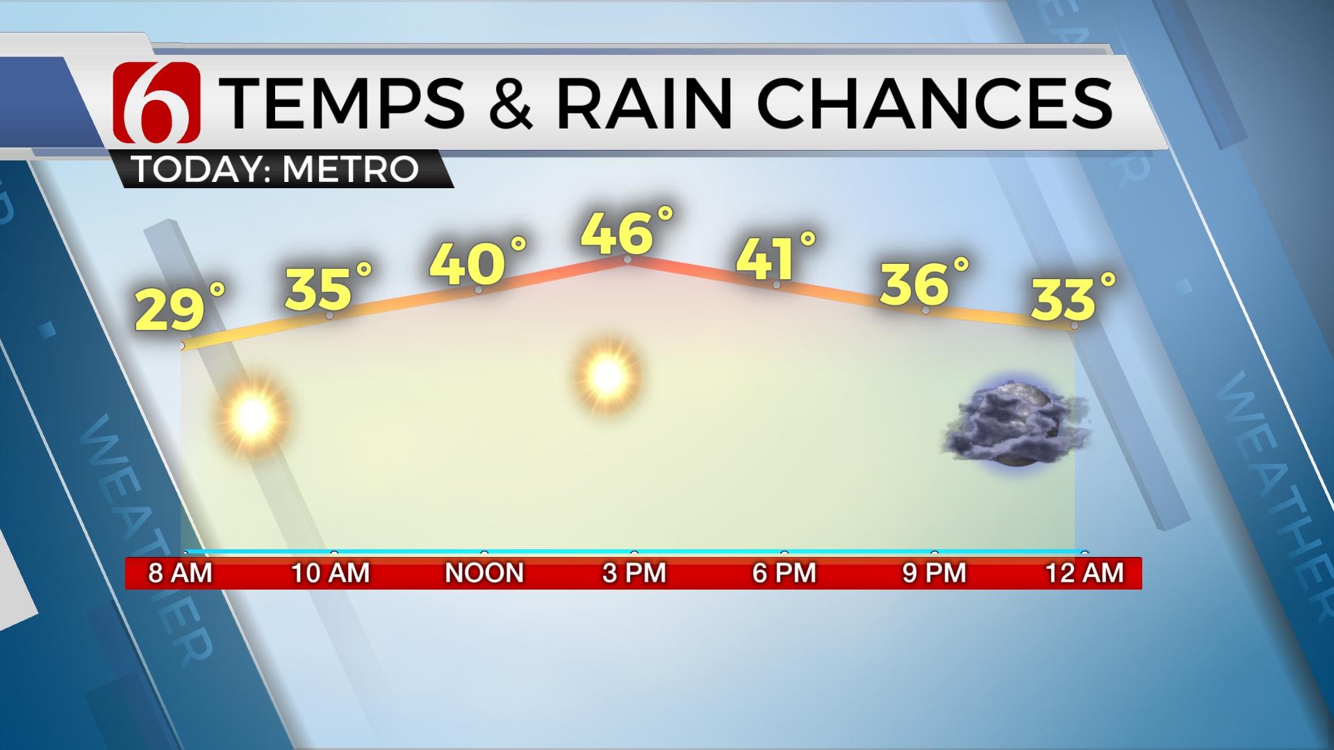
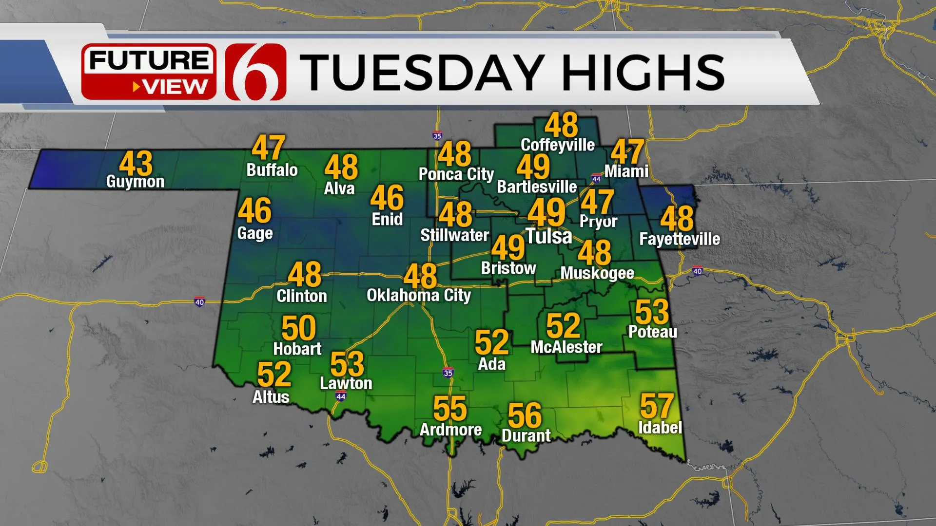
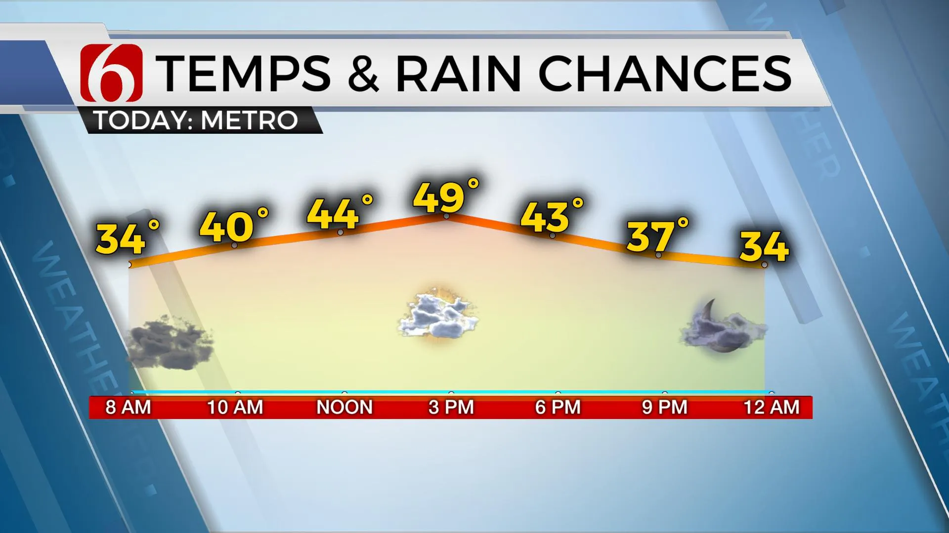
The cold front that crossed the area yesterday is located to our south with a few early morning showers lingering behind the boundary across southeastern Oklahoma early this morning. This activity will quickly end and will remain well south of the Tulsa metro. We are back into the 30s this morning with clouds along with north winds around 10 to 15 mph. Highs this afternoon will remain near normal, with highs reaching the upper 40s to lower 50s. Our daytime highs will return to the mid and upperTuesday, January 19th 2021, 4:29 am
TULSA, Okla. -
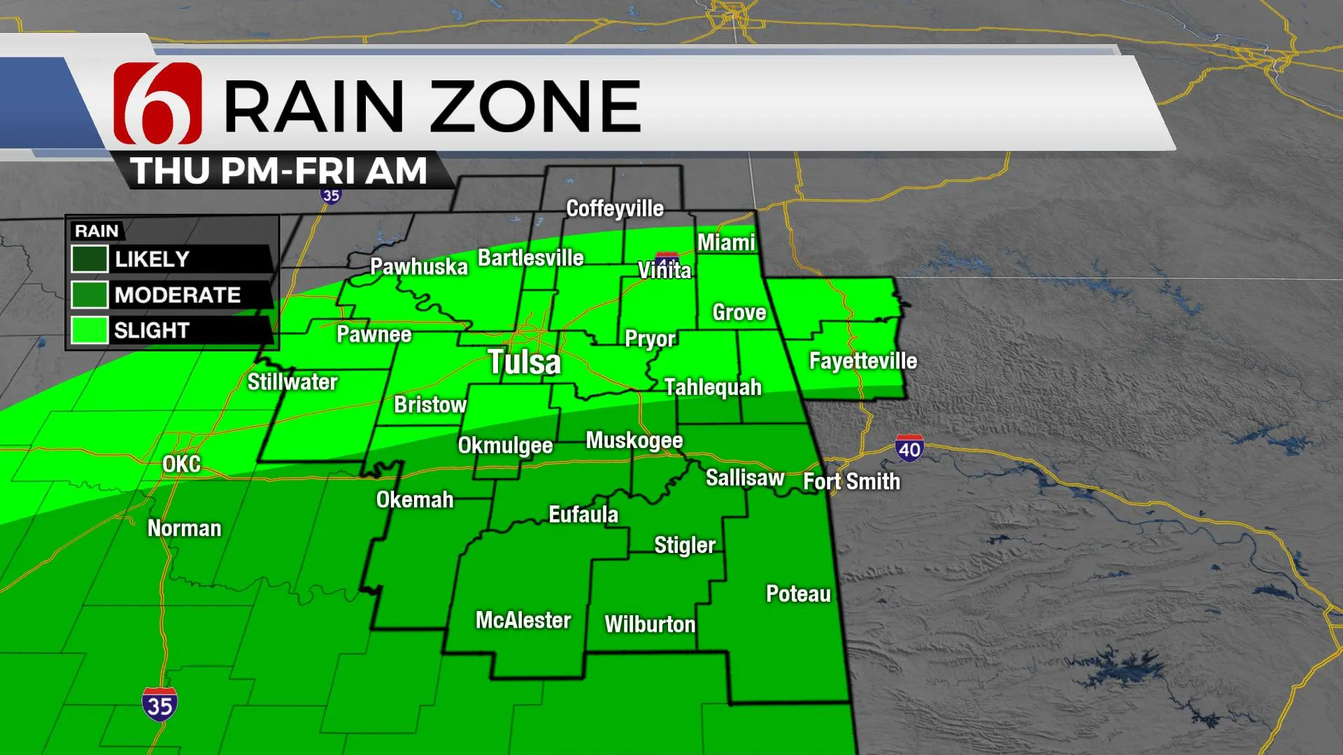
The cold front that crossed the area yesterday is located to our south with a few early morning showers lingering behind the boundary across southeastern Oklahoma early this morning. This activity will quickly end and will remain well south of the Tulsa metro. We are back into the 30s this morning with clouds along with north winds around 10 to 15 mph. Highs this afternoon will remain near normal, with highs reaching the upper 40s to lower 50s. Our daytime highs will return to the mid and upper 50s both Wednesday and Thursday as a storm system currently to our west ejects east and weakens. This will bring a few showers Wednesday and Thursday across the Red River Valley region, but this activity should remain south of the metro. I will keep a low probability for the metro region late Thursday evening into Friday as this lead wave passes the region, but chances for the metro will remain low. Another stronger system will near the state for part of the weekend bringing south winds, increasing low-level moisture, and increasing rain and thunder to part of eastern Oklahoma.
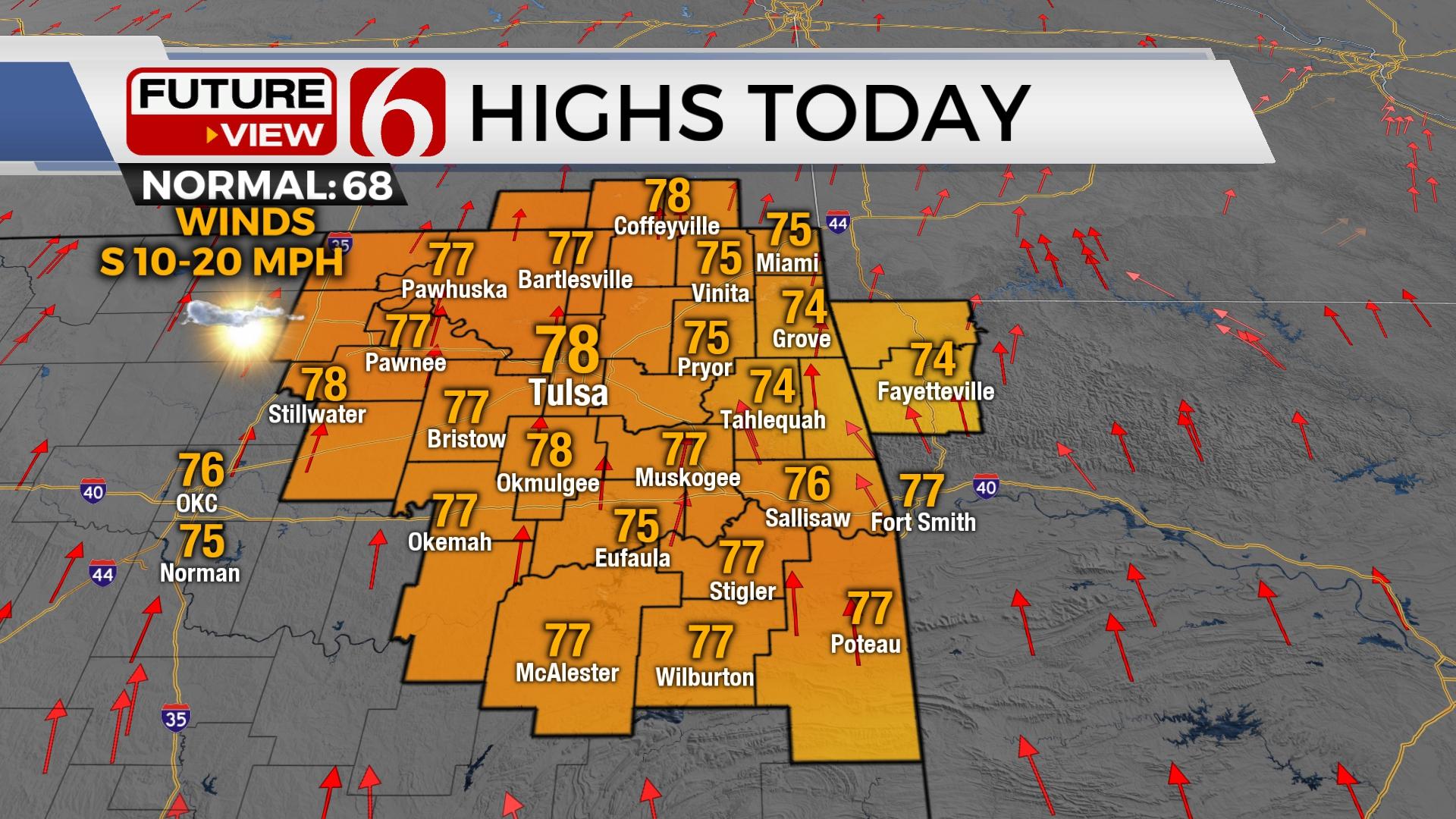
This weekend, a long-wave trough will be located across the western U.S. and will begin making quick progress eastward through the intermountain region and into the plains Sunday. Gusty south winds will return Saturday with highs reaching the mid-50s as low-level moisture begins surging northward through the day. A few showers should be possible Saturday, but the overall coverage will be limited.
Late Saturday into Sunday, the upper-level feature will near the state with a surface low developing either across southeastern Colorado or southwestern Kansas. Strong south winds will be likely Sunday with morning lows in the 40s and afternoon highs reaching at least the upper 50s or even lower 60s before the low ejects northeast and drags a surface cold front southward. As this occurs, showers and storms will become more numerous along and ahead of the front bringing increasing thunder chances to at least locations near and east of Highway 69. Enough moisture and instability would be present for thunderstorms, including at least a low mention of a few strong storms based on the pattern for Sunday evening into early Monday across far southeastern OK.
The upper airflow will be conducive to allow shallow, cold air moving southward across the northern U.S. later this week with another shot of cold air early next week. It’s likely that at least the northern two-thirds of the nation will experience this chilly airmass next week. The data suggest that most of this colder air will remain north of our immediate area.
Inauguration Day weather in Washington D.C. looks quite blustery.
Very windy weather is likely Wednesday in the Nation’s Capital with highs in the lower 40s. Wind chills will be in the upper 20s and lower 30s with northwest winds from 20 to 40 mph. A few passing flurries or very light snow showers will be possible.
Thanks for reading the Tuesday morning weather discussion and blog.
Have a super great day!
Alan Crone
KOTV
If you would rather listen to the update, check out my daily podcast weather briefing. Search for NewsOn6 and ‘Weather Out The Door’ on most podcast providers, including here on Spotify.
More Like This
January 19th, 2021
November 30th, 2022
November 1st, 2022
August 26th, 2022
Top Headlines
December 13th, 2024
December 13th, 2024
December 13th, 2024
December 13th, 2024


