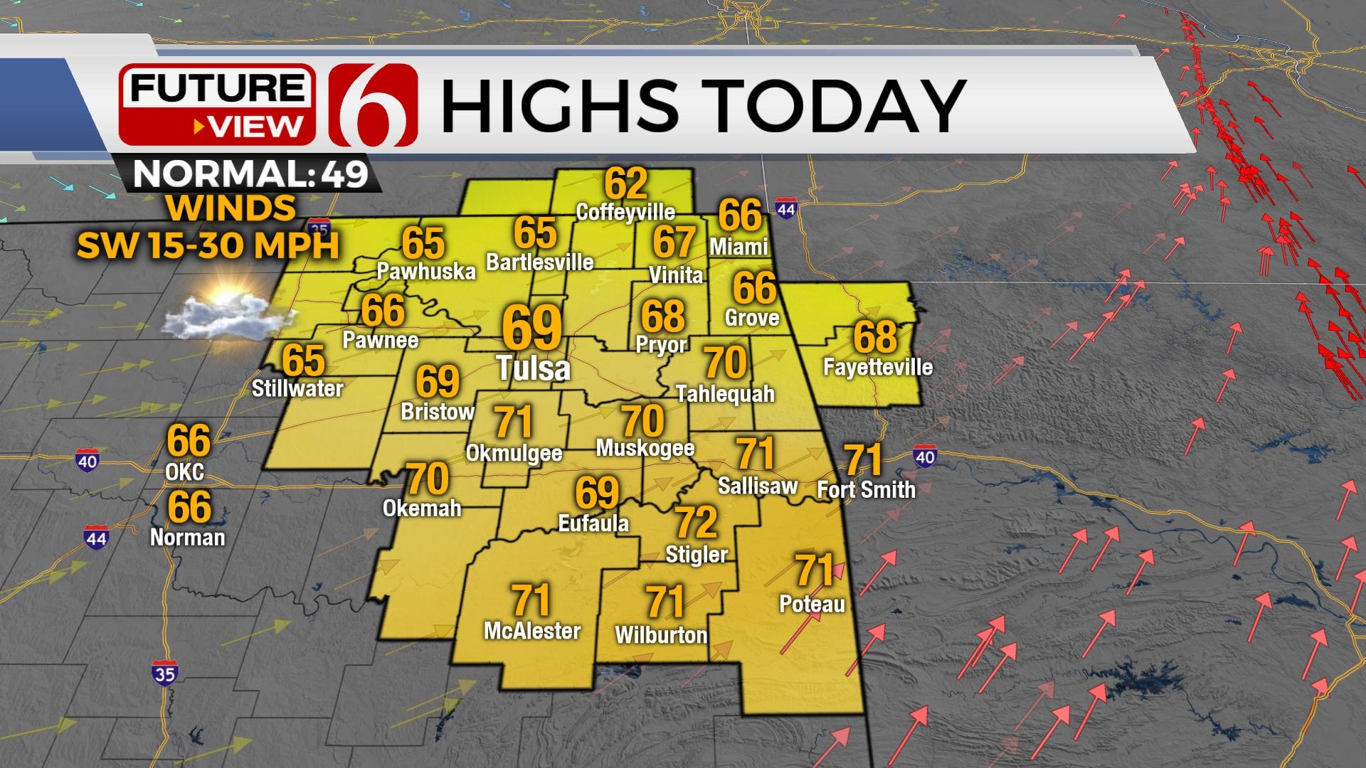
Gusty Winds Bring Above Normal Highs
A warm and breezy day is ahead.Monday, January 16th 2023, 6:24 am
If you’re into podcasts or in a rush, check out my daily weather update. Search for NewsOn6 and ‘Weather Out The Door’ on most podcast providers, including Spotify, Stitcher and Tune-In, or Click Here to listen on Apple Podcasts.
TULSA, Okla. - A warm and breezy day is ahead.
Here are the details from News On 6 Meteorologist Alan Crone:
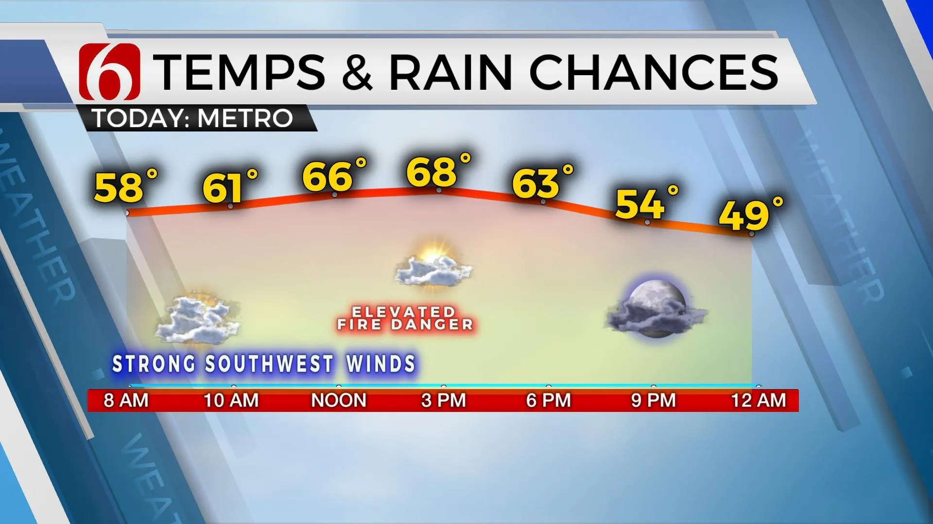
Strong southwest winds will remain for the early to midday period with decreasing clouds and highs in the upper 60s to lower 70s. The overall pattern remains quite active with several systems nearing Oklahoma, including the potential for showers and storms Tuesday evening into early Wednesday. No major cold air is anticipated in the near-term, but the pattern will support colder weather and possibly wintery weather precipitation soon.
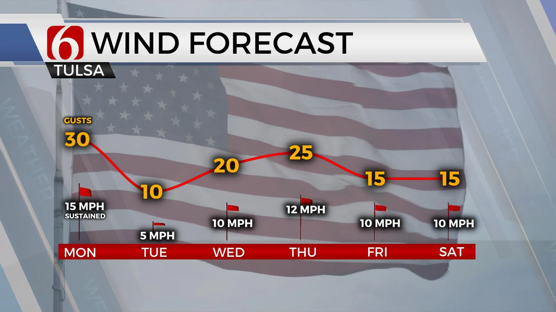
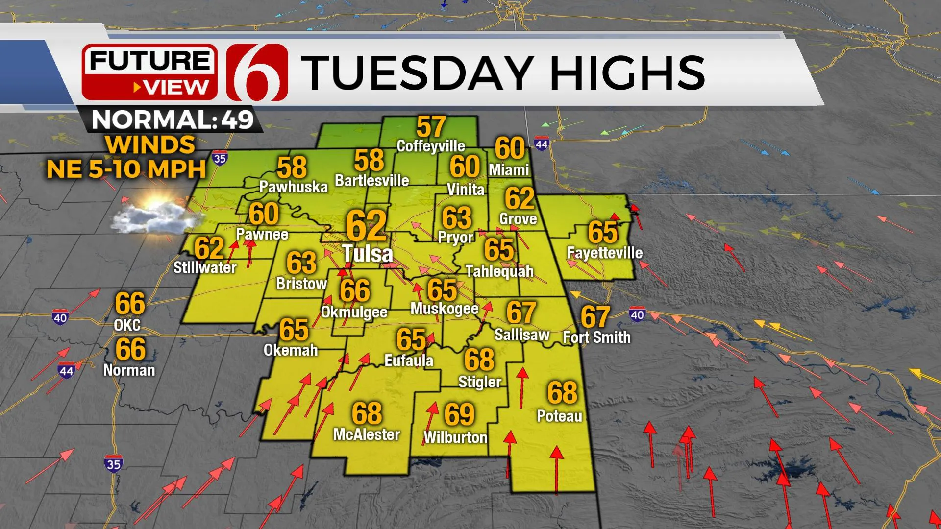
A quick upper-level system is exiting the area early Monday morning and will take the clouds eastward after the early morning hours. Strong and gusty south winds, still gusting to near 40 mph, will veer mostly from the southwest this afternoon at 15 to 20 mph with drier low-level air arriving from the west. Combined with sunshine, daytime highs will reach the upper 60s and lower 70s near and southwest of Tulsa, and into the lower and mid-60s across far northeastern sections of the state. The fire danger remains elevated. A weak boundary provides a north wind for part of Tuesday before our next slower and stronger upper system arrives from the west. Low-level moisture will attempt a fast return but may still not be deep enough for meaningful precipitation across the state. The true warm sector of the cyclone is expected to remain slightly southeast of our immediate area. This means the greater threat of severe weather is also expected to remain southeast for the Wednesday system, but a few strong storms may still occur across the far southeastern Oklahoma Wednesday morning to midday. Another system nears this weekend. The data is inconclusive toward the exact outcome, but additional showers will be possible Saturday evening into early Sunday morning. The potential for colder weather arriving Saturday evening into Sunday could provide the potential for some wintry weather impacts, but the overall confidence remains too low for any major concerns at this point.
Thanks for reading the Monday morning weather discussion and blog.
Have a super great day!
Alan Crone
KOTV
More Like This
January 16th, 2023
July 3rd, 2023
June 8th, 2023
June 6th, 2023
Top Headlines
March 13th, 2025
March 13th, 2025


