Tracking A Weekend Storm
Expect cold weather as you head out the door on Thursday morning after showers and storms swept across the state on Wednesday.Thursday, February 23rd 2023, 6:05 am
If you’re into podcasts or in a rush, check out my daily weather update. Search for NewsOn6 and ‘Weather Out The Door’ on most podcast providers, including Spotify, Stitcher and Tune-In, or Click Here to listen on Apple Podcasts.
TULSA, Okla. - Expect cold weather as you head out the door on Thursday morning after showers and storms swept across the state on Wednesday.
Here are the details from News On 6 Meteorologist Alan Crone:

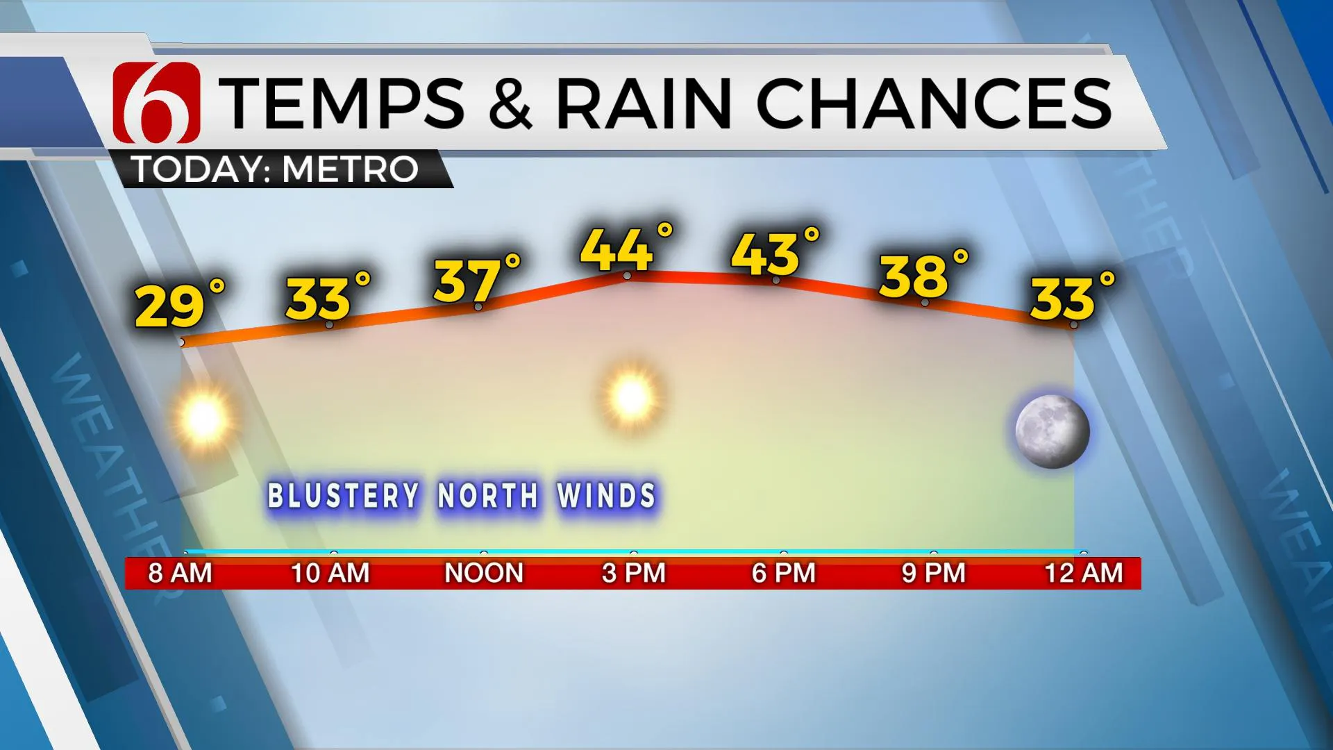
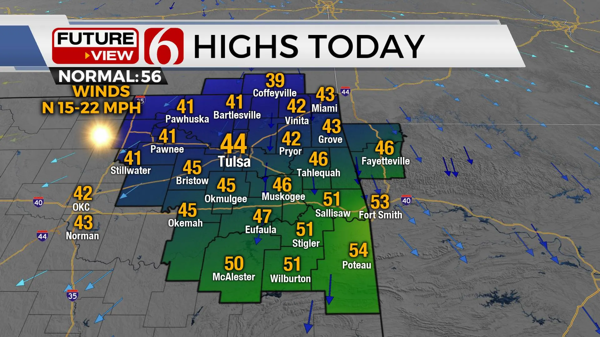
The cold front has moved across northern Oklahoma earlier Thursday morning and is proceeding south into far southeastern sections through the morning hours. After highs in the 70s on Wednesday afternoon, morning lows in the 20s and 30s will rebound with highs only in the lower to mid-40s north and upper 40s to near 50 south. North winds from 15 to 25 mph will persist for the first half of the day before easing some Friday. Friday morning lows will be the coldest of this current cold snap with lows in the lower to mid-20s. Afternoon highs Friday will stay in the mid to upper 40s with a return of south winds by afternoon and evening as clouds increase throughout the region.

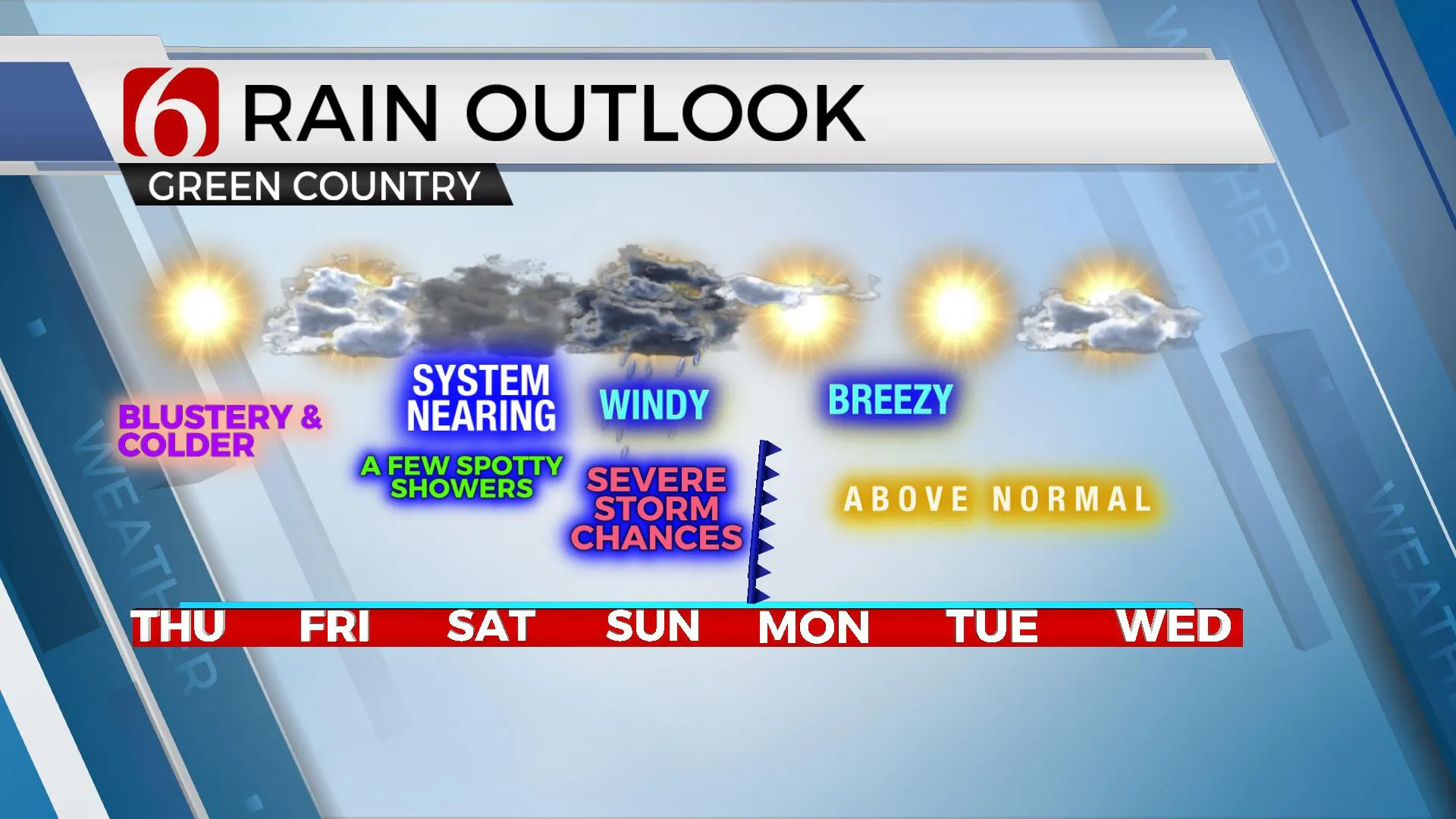
Later Friday afternoon, a weak upper-level disturbance nearing from the southwest may trigger a few showers into the evening hours. Some of these may be present during the day Saturday with afternoon highs in the lower 50s. Saturday evening into Sunday morning a slightly higher chance for a few showers or isolated storms will arrive, but again, most locations should remain dry near Tulsa with higher chances along the I-40 corridor. Sunday afternoon highs will reach the mid to upper 60s with strong south winds developing ahead of another powerful storm system. This system is digging south along the Pacific coastal region bringing rain and snow to California soon. A blizzard warning will be underway for the mountains of Los Angeles County later tonight into part of Saturday morning. This same upper-level system will be near Oklahoma Sunday bringing another high probability of rain and thunderstorms from the west to east Sunday evening into pre-dawn Monday. Locally heavy rainfall is likely. There will also be a chance for severe weather with this system. The higher threat for significant severe threats currently will reside across the western half of the state Sunday evening, but some severe threats will exist with the system as it moves into northeastern Oklahoma late Sunday and pre-dawn Monday. We'll have more about this system tomorrow.

Thanks for reading the Thursday morning weather discussion and blog.
Have a super great day!
Alan Crone
KOTV
More Like This
February 23rd, 2023
July 3rd, 2023
June 8th, 2023
June 6th, 2023
Top Headlines
December 14th, 2024
December 14th, 2024
December 14th, 2024
December 14th, 2024


