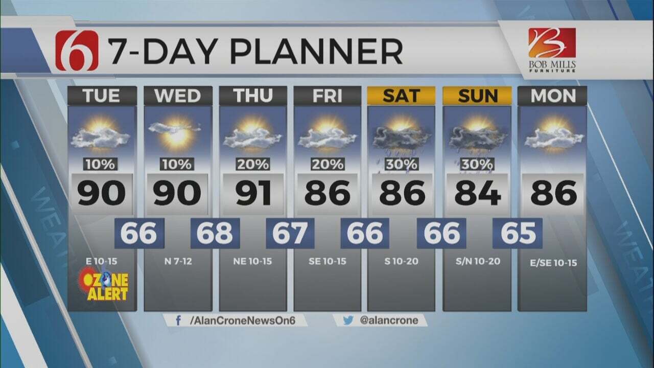
Another Wet & Chilly Day
Grab a jacket, another day of rain and chilly temperatures is ahead.Wednesday, February 8th 2023, 5:14 am
If you’re into podcasts or in a rush, check out my daily weather update. Search for NewsOn6 and ‘Weather Out The Door’ on most podcast providers, including Spotify, Stitcher and Tune-In, or Click Here to listen on Apple Podcasts.
TULSA, Okla. - Grab a jacket, another day of rain and chilly temperatures is ahead.
Here are the details from News On 6 Meteorologist Alan Crone:
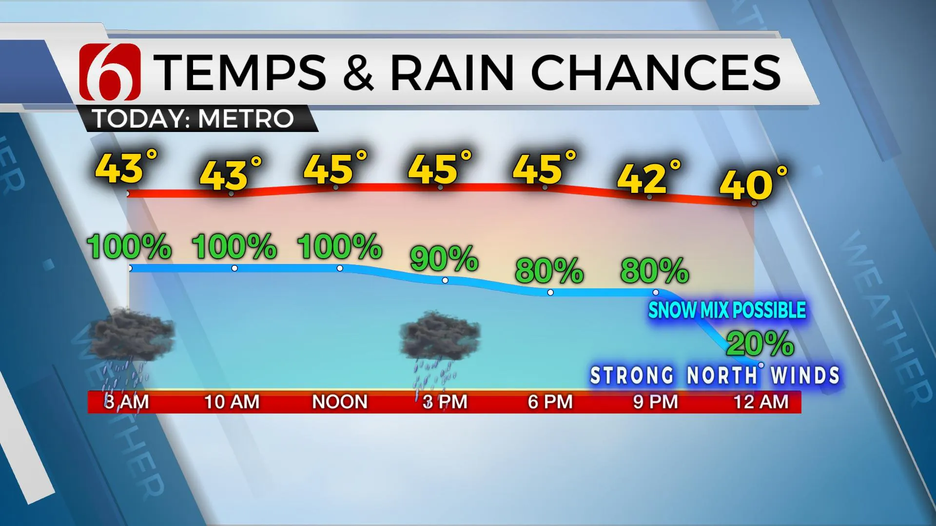
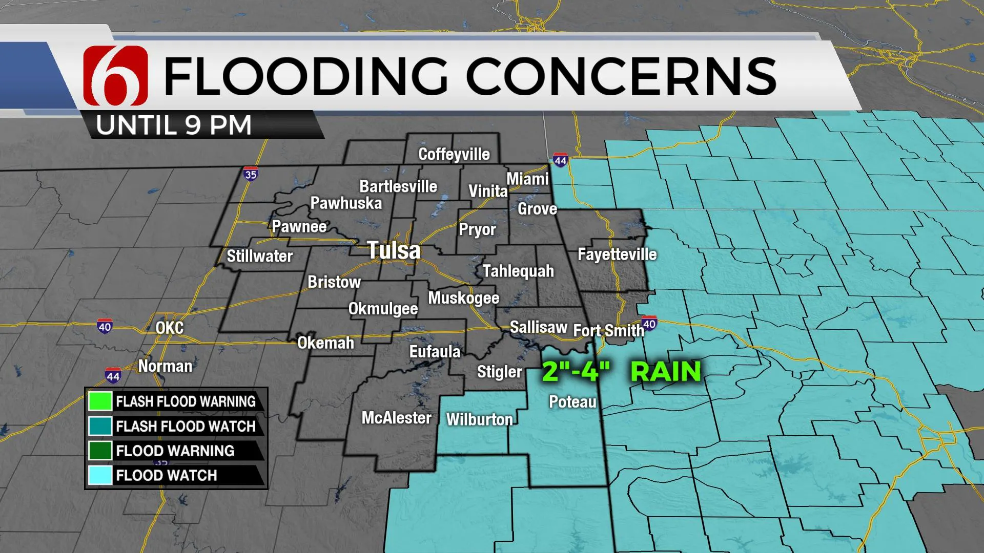
The chilly and wet weather pattern will remain on Wednesday before the main upper-level system moves across northern Oklahoma and southern Kansas on Wednesday night, signaling the end of this current round of precipitation. As the colder air aloft brushes far northern Oklahoma later on Wednesday night, there will remain a chance for some rain to mix with or flip over into some light snow shower activity along the OK and KS state line region. Before this occurs, some pockets of moderate to heavy downpours will be possible near and east of the metro later Wednesday afternoon. Some rainfall amounts nearing one to two inches possible near Tulsa, with one to three inches across far southeastern to east central OK. Some locally heavy rainfall could result in localized increase of river and stream levels across the far eastern third of the state. A flood watch is now in effect through tonight across far southeastern OK until 9 p.m. Wednesday.
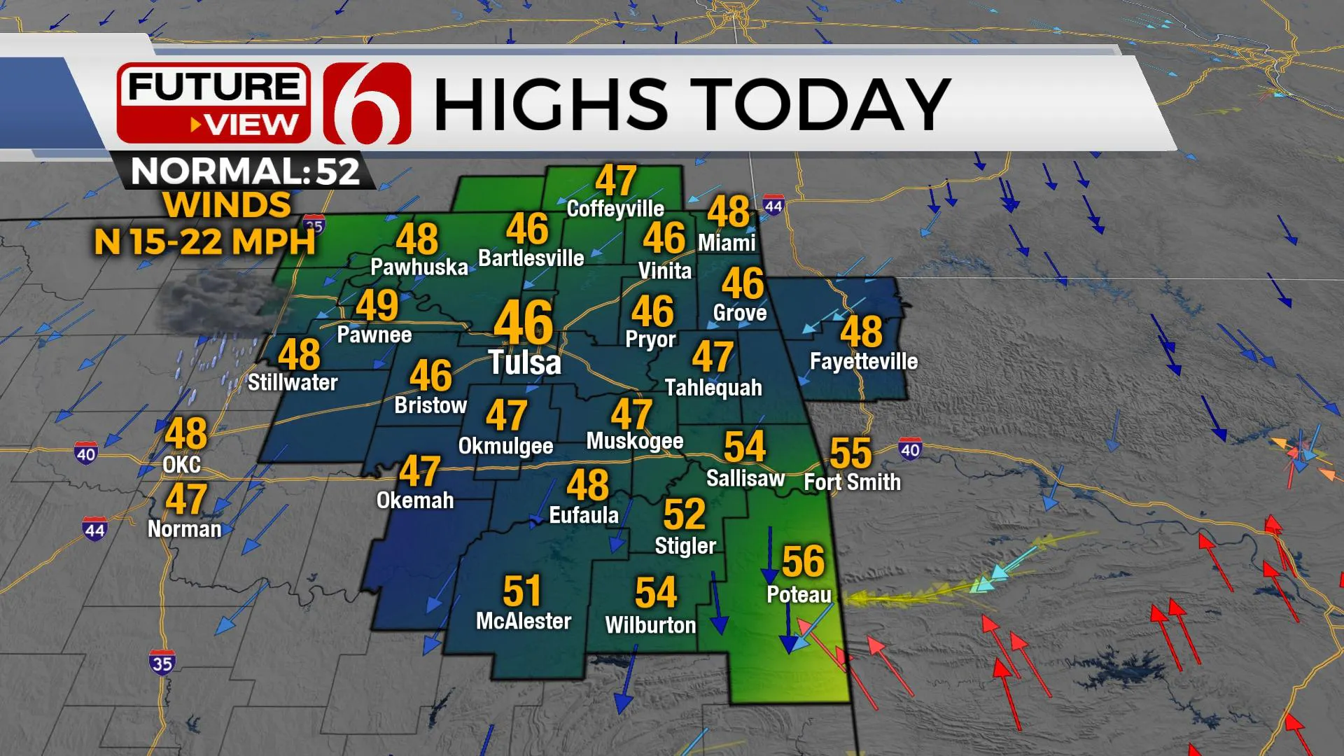
As the system exits, clouds should clear out early Thursday with morning lows in the 30s reaching afternoon highs in the upper 40s to lower 50s. The next fast-moving system clips our area Thursday evening into pre-dawn Friday. This could bring some light snow showers along the OK-KS state line region, but the chance remains low. Most data have been trended slightly more northward with any impactful weather. But the low chance will remain for this system with some light snow shower or at least some flurries. This will keep temps Friday on the cold side, with afternoon highs in the lower 40s along with gusty northwest winds from 15 to 25 mph.
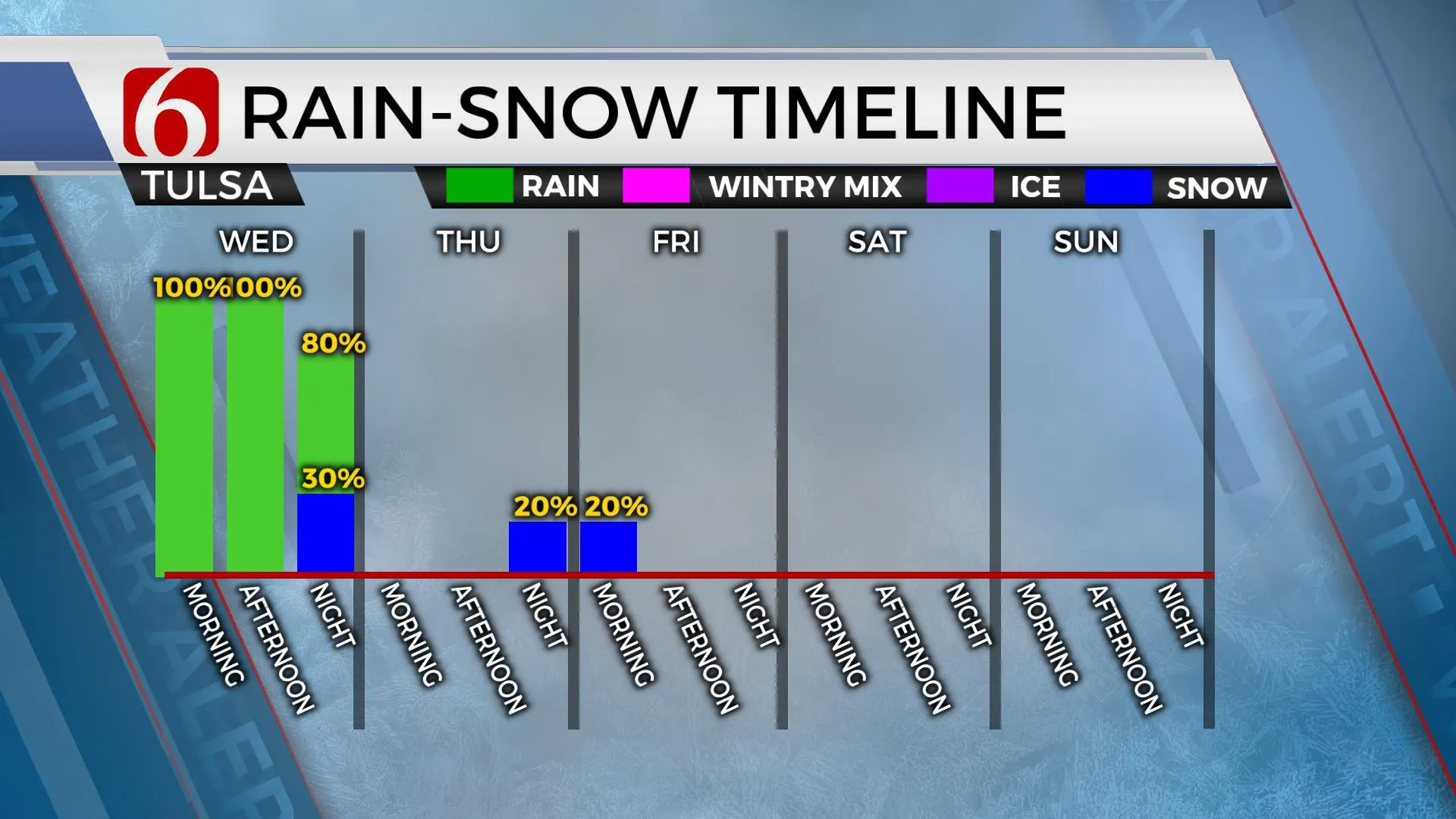
The weekend outlook has not changed significantly compared to previous updates:
The weekend features lows in the 20s and 30s and highs in the 50s along with a southwest wind from 10 to 20 mph Saturday and 20 to 30 mph Sunday. A powerful upper-level system is likely to impact the central and southern plains early next week with increasing wind and probabilities for precipitation. It's too early to pinpoint specifics, but the pattern would suggest the potential for some impactful weather, mostly Tuesday.
Thanks for reading the Wednesday morning weather discussion and blog.
Have a super great day!
Alan Crone
KOTV
More Like This
February 8th, 2023
July 3rd, 2023
June 8th, 2023
June 6th, 2023
Top Headlines
December 12th, 2024
December 12th, 2024
December 12th, 2024
December 12th, 2024


