Big Wednesday Warm-Up Brings Thursday Storm Chances
Warm and windy weather sticks around for another day before storm chances return to Green Country.Wednesday, March 22nd 2023, 4:56 am
If you’re into podcasts or in a rush, check out my daily weather update. Search for NewsOn6 and ‘Weather Out The Door’ on most podcast providers, including Spotify, Stitcher and Tune-In, or Click Here to listen on Apple Podcasts.
TULSA, Okla. - Warm and windy weather sticks around for another day before storm chances return to Green Country.
Here are the details from News On 6 Meteorologist Alan Crone:
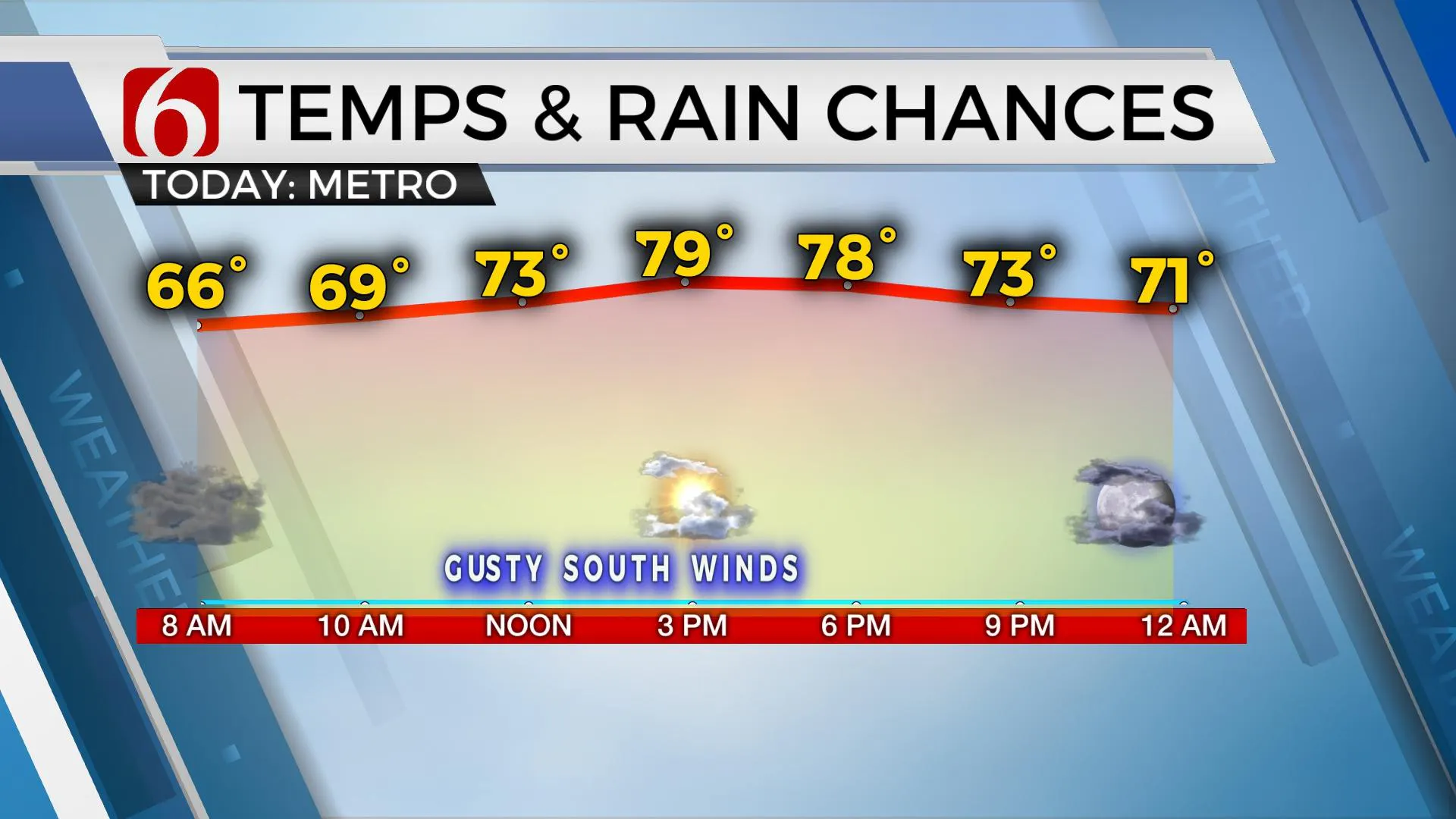
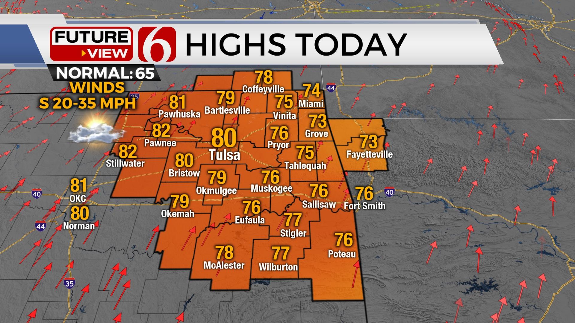
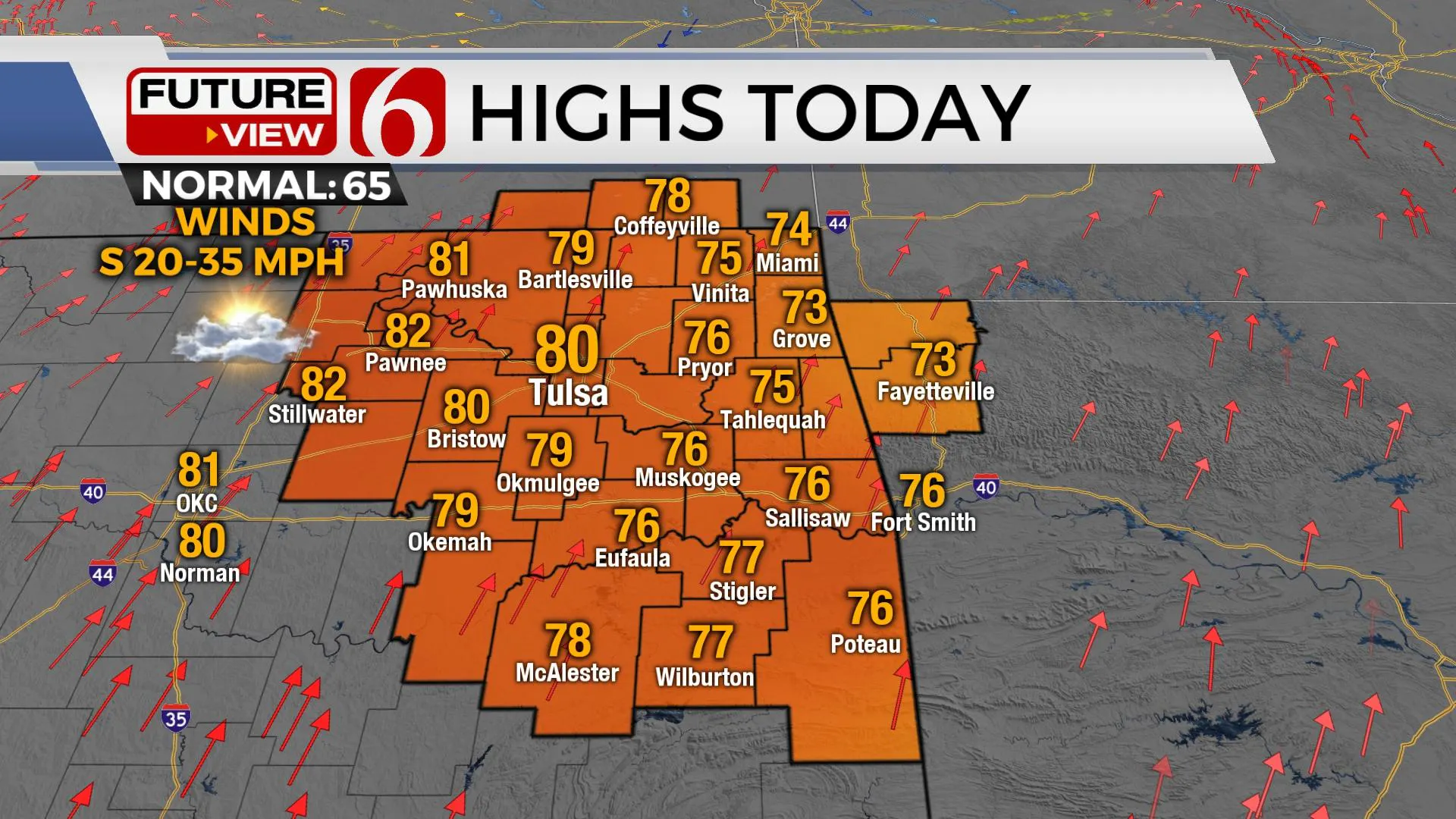
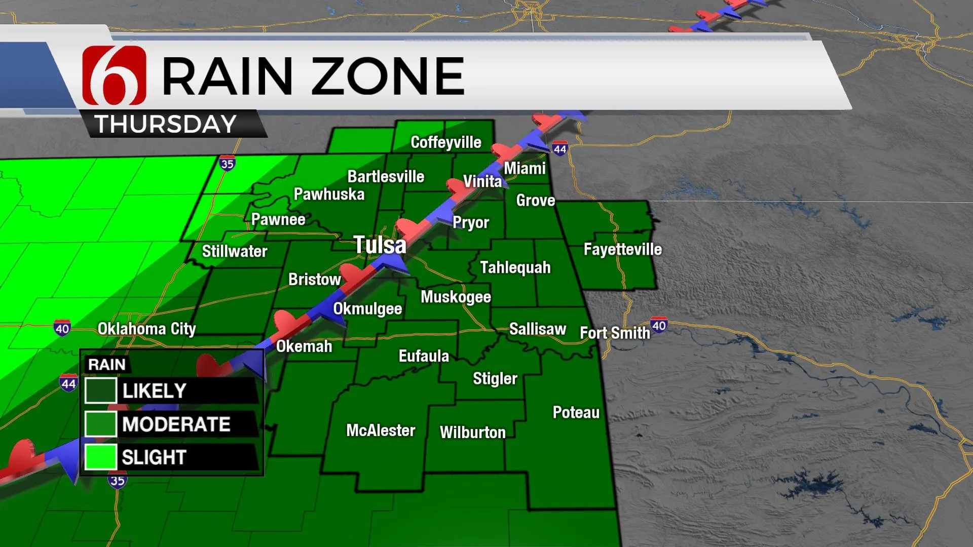
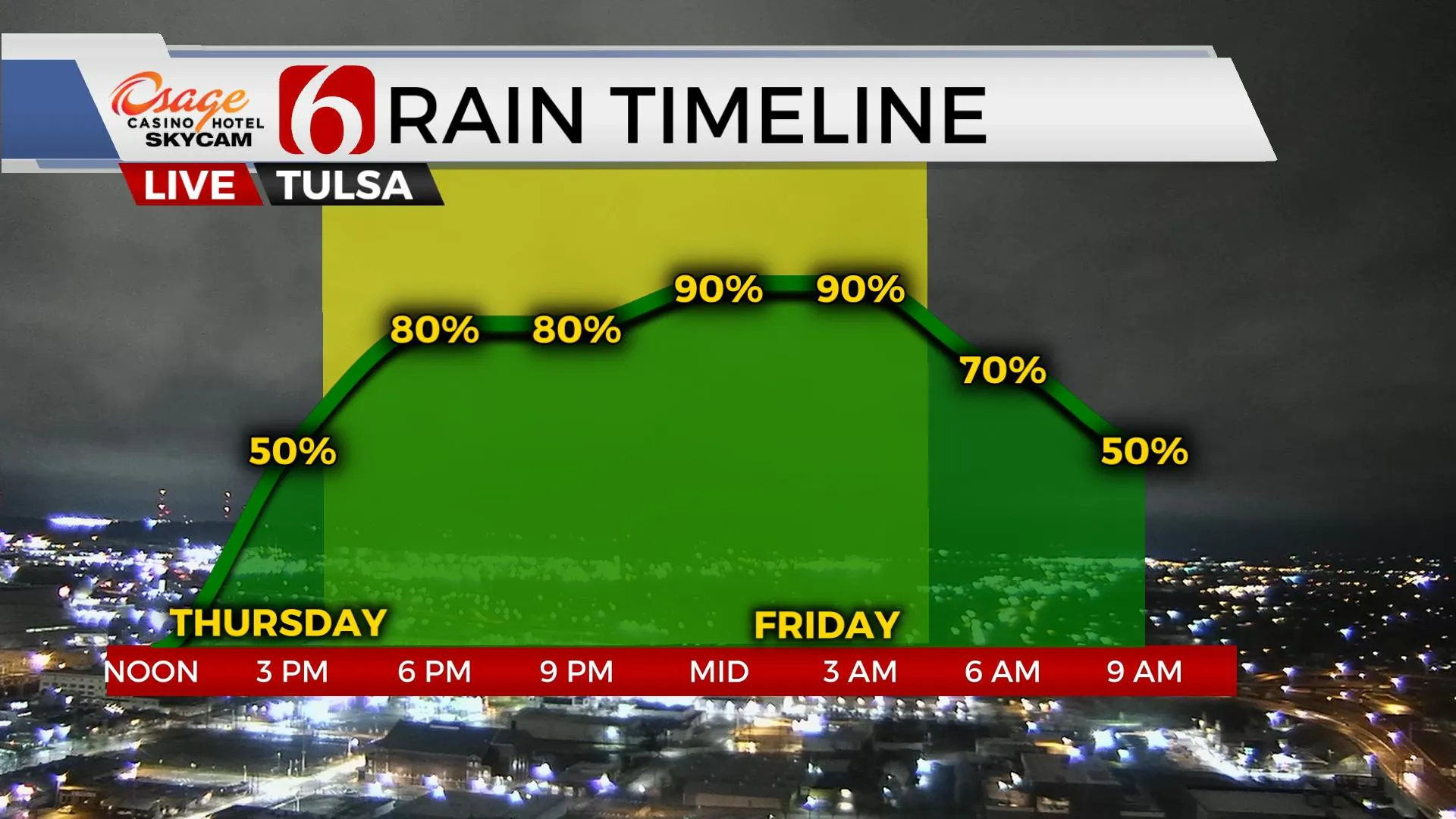
Gusty south winds from 20 to 35 mph will remain on Wednesday with afternoon highs reaching the mid to upper 70s across most of eastern Oklahoma. We’ve placed the Tulsa metro high at 80 on Wednesday with a sunshine-cloud mix. The next storm system nears quickly Thursday before slowing down before exiting overnight into Friday morning. Pockets of moderate to heavy rainfall will be possible slightly southeast of the Tulsa metro where one to three inches of rain will be possible. This system also brings the potential for strong and severe storms. As the system exits early Friday morning, some lingering showers will be possible for the early morning hours with gusty north winds and highs in the upper 50s and lower 60s. Another fast-developing system is possible Sunday, but our probabilities currently remain low for the metro with higher chances both across far southeastern OK and southeastern Kansas.
The data continue suggesting a cold front will enter northern OK Thursday midday and move southeast as the main upper-level trough nears from the west. The progression of this front will hold the key to higher chances for showers and storms. Dew points in the 60s will be pooling along and ahead of the boundary Thursday morning but would slide slightly south of the Tulsa metro Thursday evening as the front moves slowly southeast before stalling Thursday night. This will keep higher probabilities for strong and severe storms near and south of the Tulsa metro. Main threats appear to be hail, wind, and heavy rainfall. A low tornado threat remains with any discrete cells that could latch onto the slowly moving boundary.
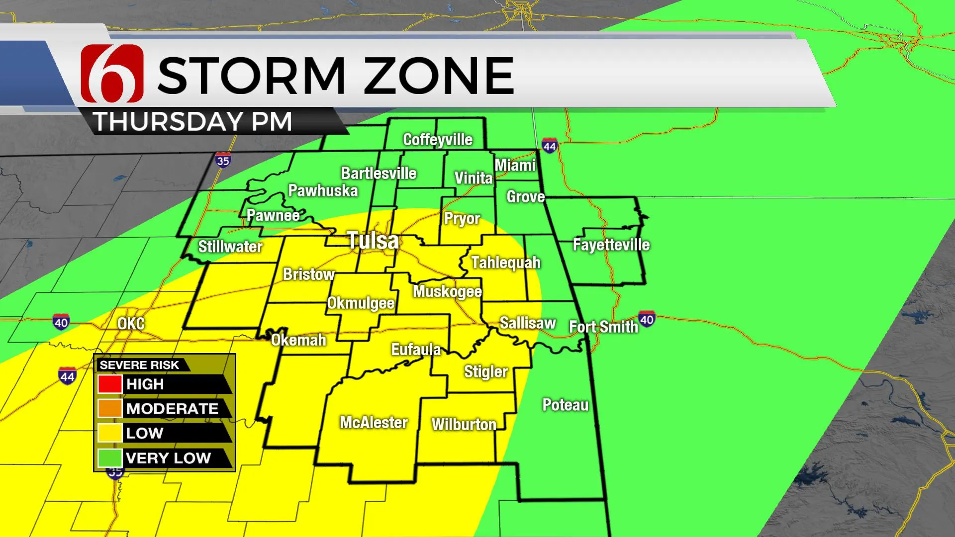
The upper air flow will become more parallel to the boundary Thursday evening promoting several rounds of heavy rainfall producing storms that could move across the same areas before exiting Friday morning. This pattern can result in pockets of localized flooding issues, including increasing river, stream, and creek flows. A flood watch may eventually be needed for some locations south and east of the Tulsa metro for Thursday evening through early Friday morning.
Gusty north winds return Friday with afternoon highs in the upper 50s and lower 60s. There remains a slight chance that a few showers could develop on the departing back-side of the upper trough Friday night, but I have not included this low-end chance for now.
Another medium wave trough nears Saturday night and should promote the growth of another surface low pressure area along the River Red River Valley that moves eastward through the morning to midday. A few scattered showers or storms will be possible with highs in the upper 60s and lower 70s before another cold front sweeps southward Sunday night with slightly cooler and stable air Monday with highs in the upper 50s to lower 60s.
Thanks for reading the Wednesday morning weather discussion and blog.
Have a super great day!
Alan Crone
KOTV
More Like This
March 22nd, 2023
July 3rd, 2023
June 8th, 2023
June 6th, 2023
Top Headlines
December 13th, 2024
December 13th, 2024
December 13th, 2024
December 13th, 2024

