Watching For Storms As The Weekend Approaches
Expect warm and windy weather as you head out the door.Thursday, April 13th 2023, 5:54 am
If you’re into podcasts or in a rush, check out my daily weather update. Search for NewsOn6 and ‘Weather Out The Door’ on most podcast providers, including Spotify, Stitcher and Tune-In, or Click Here to listen on Apple Podcasts.
TULSA, Okla. - Expect warm and windy weather as you head out the door.

Here are the details from News On 6 Meteorologist Alan Crone:
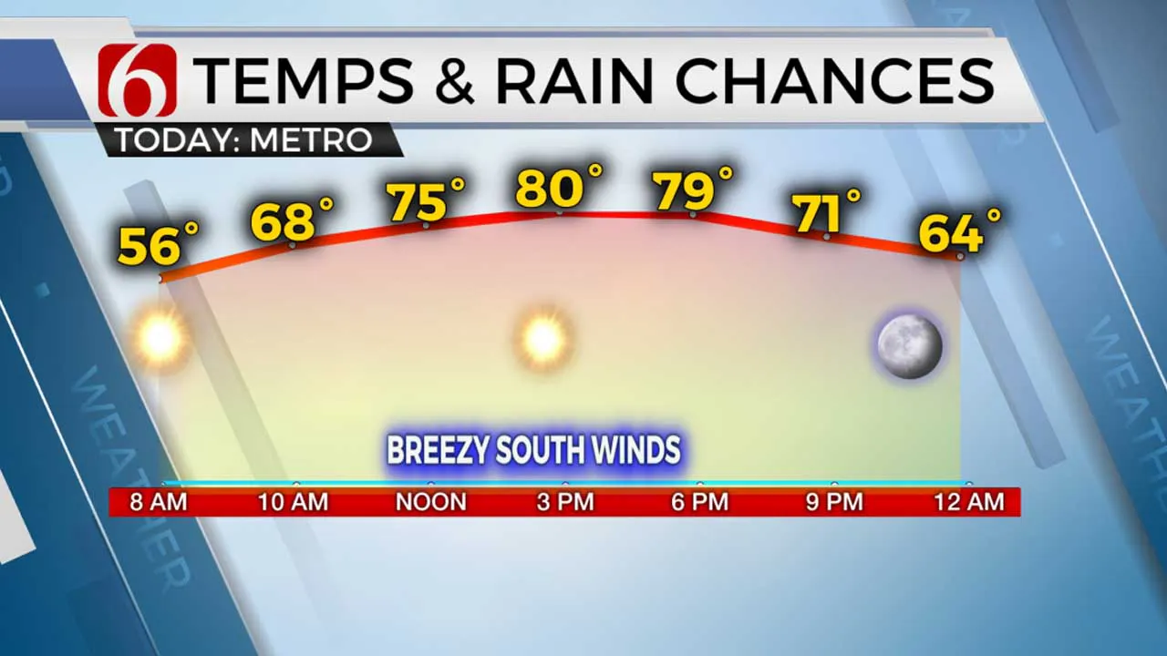
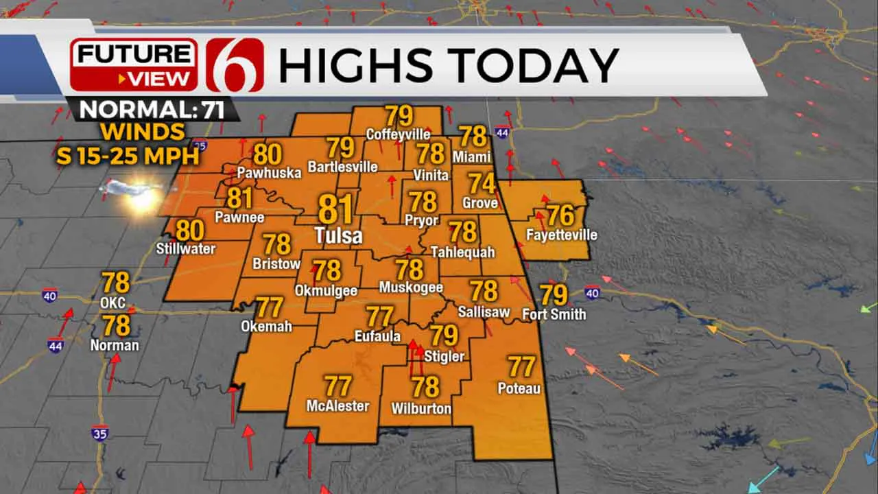
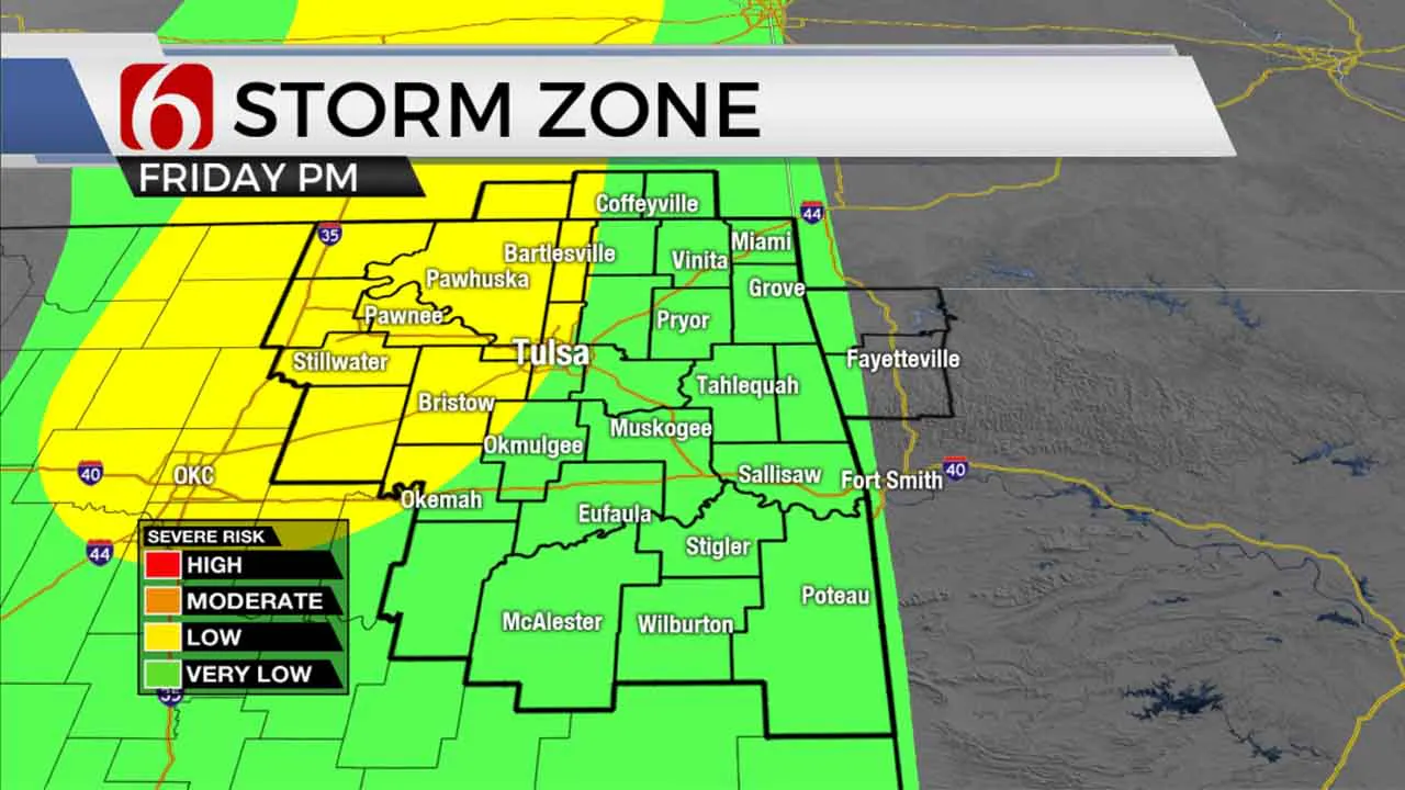
Our next storm system nears the state Friday bringing windy weather with highs in the upper 70s and lower 80s. Storm chances will remain for part of the area, but the chance is highly conditional due to the presence of a capping inversion. Highs this afternoon will reach the upper 70s and lower 80s. Friday morning starts in the mid to upper 50s with highs remaining near 80 with partly cloudy conditions. South winds are likely from 20 to near 40 mph by afternoon and evening. The main upper trough will near the plains Friday bringing strong winds aloft across the region. A very small disturbance moves across northern Oklahoma Friday morning and may produce a small shower or two. This chance remains very low. Our main window of interest remains late Friday night into pre-dawn Saturday.

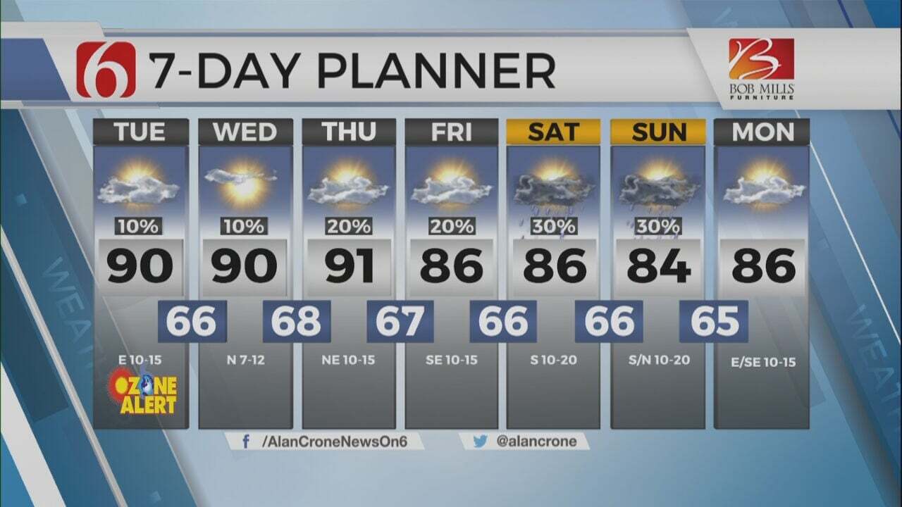
A dry line and cold front will be nearing the state through the day. A layer of warm air aloft (The CAP) has been depicted in most data for most of the day. This will act to suppress or limit storm possibilities for most of the area. By the evening as colder air aloft nears the region, the CAP may begin to weaken. If so, any storms that develop would be highly severe with all modes of severe weather likely. But most data continue suggesting very little activity will form ahead of these features. Due to the potential for some high-end threats, we’ll continue to keep a chance for storms in the forecast for Friday evening, possibly into pre-dawn Saturday before the cold front catches and overpasses the dry line. Gusty northwest winds from 20 to 35 mph will follow the cold front passage Saturday morning. Data has trended cooler with post-frontal temps Saturday afternoon. We’ve made a few adjustments compared to previous data. Saturday morning temps will be in the upper 60s but may drop into the 50s by afternoon with the gusty northwest winds. During scenarios such as this, we may ‘invert’ the temps with the warmer readings for the morning hours and the cooler readings for the afternoon. The 7-day planner does not reflect this trend yet, but we may invert Saturday temps soon. The pressure gradient appears stronger in the data today and may keep the winds brisk from the northwest for Sunday also. Sunday morning lows will start in the lower to mid-40s near Tulsa and cooler in the valleys with afternoon highs in the upper 60s and lower 70s.

Another system will slowly approach the area by the middle of next week with additional storm chances, including the mention for strong to severe storms.
Thanks for reading the Thursday morning weather discussion and blog.
Have a super great day!
Alan Crone
KOTV
More Like This
April 13th, 2023
July 3rd, 2023
June 8th, 2023
June 6th, 2023
Top Headlines
December 11th, 2024
December 11th, 2024
December 11th, 2024


