

Pleasant Weekend Ahead
Cooler weather hangs around on Friday and sticks around for the weekend before shower and storm chances return next week.Friday, April 21st 2023, 6:03 am
If you’re into podcasts or in a rush, check out my daily weather update. Search for NewsOn6 and ‘Weather Out The Door’ on most podcast providers, including Spotify, Stitcher and Tune-In, or Click Here to listen on Apple Podcasts.
TULSA, Okla. - Cooler weather hangs around on Friday and sticks around for the weekend before shower and storm chances return next week.
Here are the details from News On 6 Meteorologist Alan Crone:
A pleasant weekend is likely with cooler than usual temperatures into next week. But we’ll be looking at several different scenarios for the next few days, mostly minor, that could throw us a few curveballs. A small wave on Friday morning will bring scattered clouds and possibly a sprinkle at times, yet the probability remains low. Another wave this weekend has different timing in some of the data which is problematic regarding what time we need to mention a shower chance. This probability also remains low for most of the northern areas but will be higher in the south. And finally, a stronger signal for beneficial rain arrives early next week, yet some differences remain regarding the exact position of a warm front that could be the difference between a stable chilly rain versus severe weather threats.
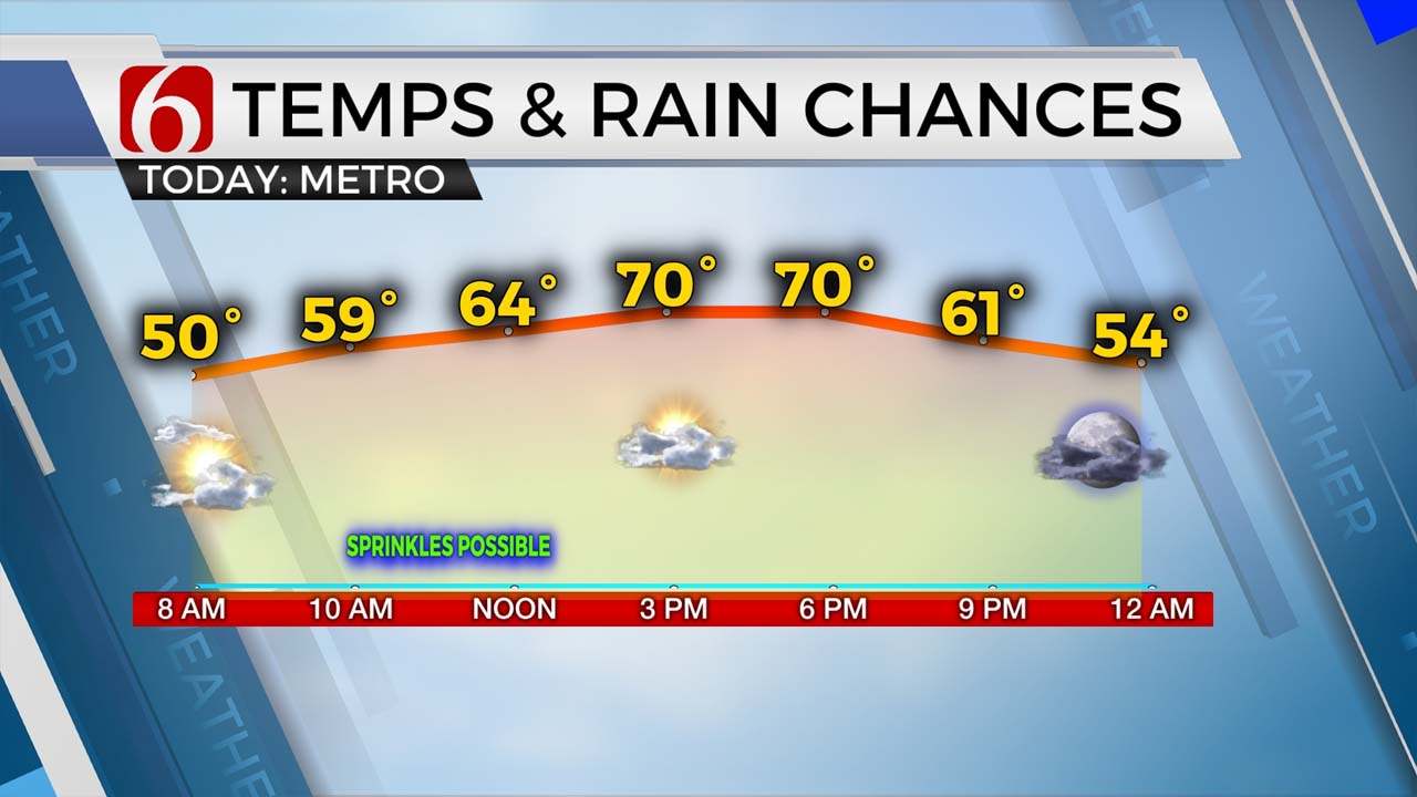
We’ll keep a small mention today for a sprinkle or two around midday with some broken clouds. After a chilly start in the 40s, highs this afternoon should reach the upper 60s and lower 70s along with north winds from 10 to near 25 mph along with a sun-cloud mix.
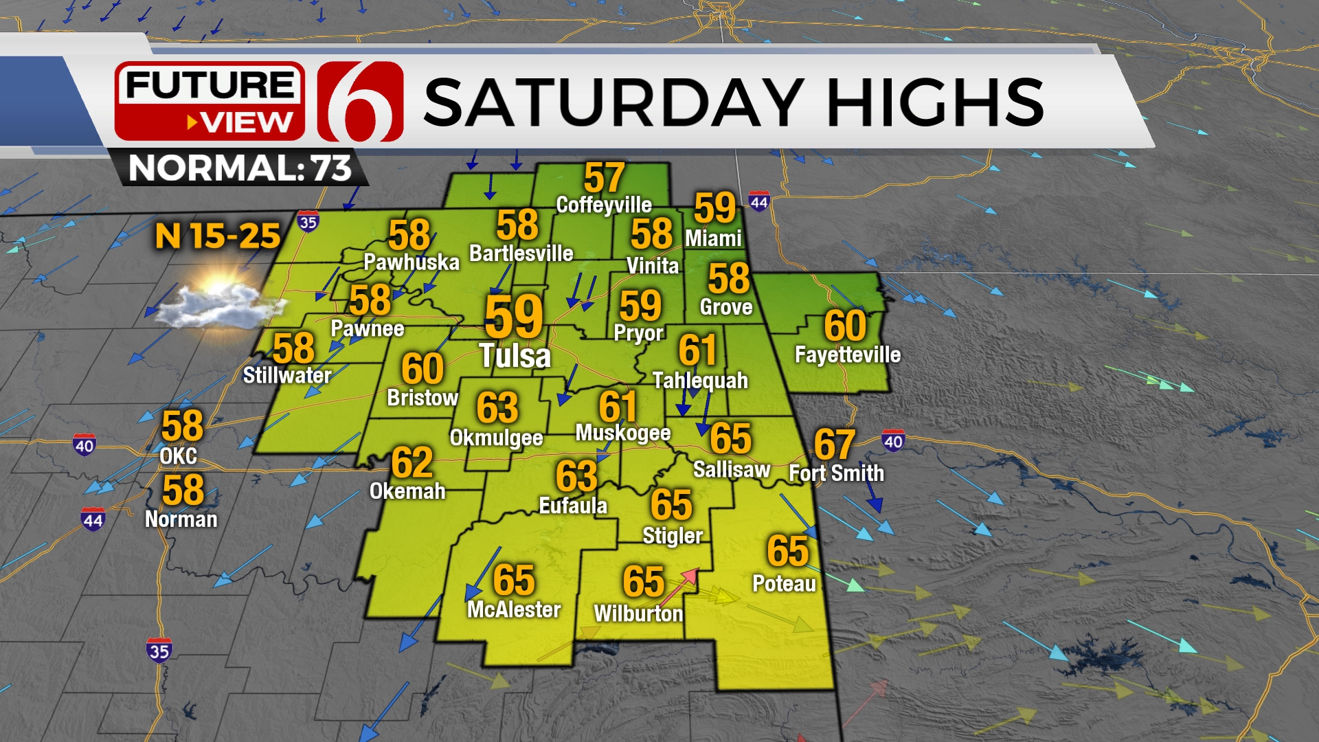
Saturday morning lows will also start mostly in the lower 40s but finish only in the upper 50s and lower 60s as a weak boundary moves across the area early Saturday morning keeping the cool weather intact for the weekend. Some data bring a small lobe of energy behind this wave Saturday evening across the northern third of the state. This would produce a small area of showers and clouds for the evening hours. We’ll ignore this precip output for now.
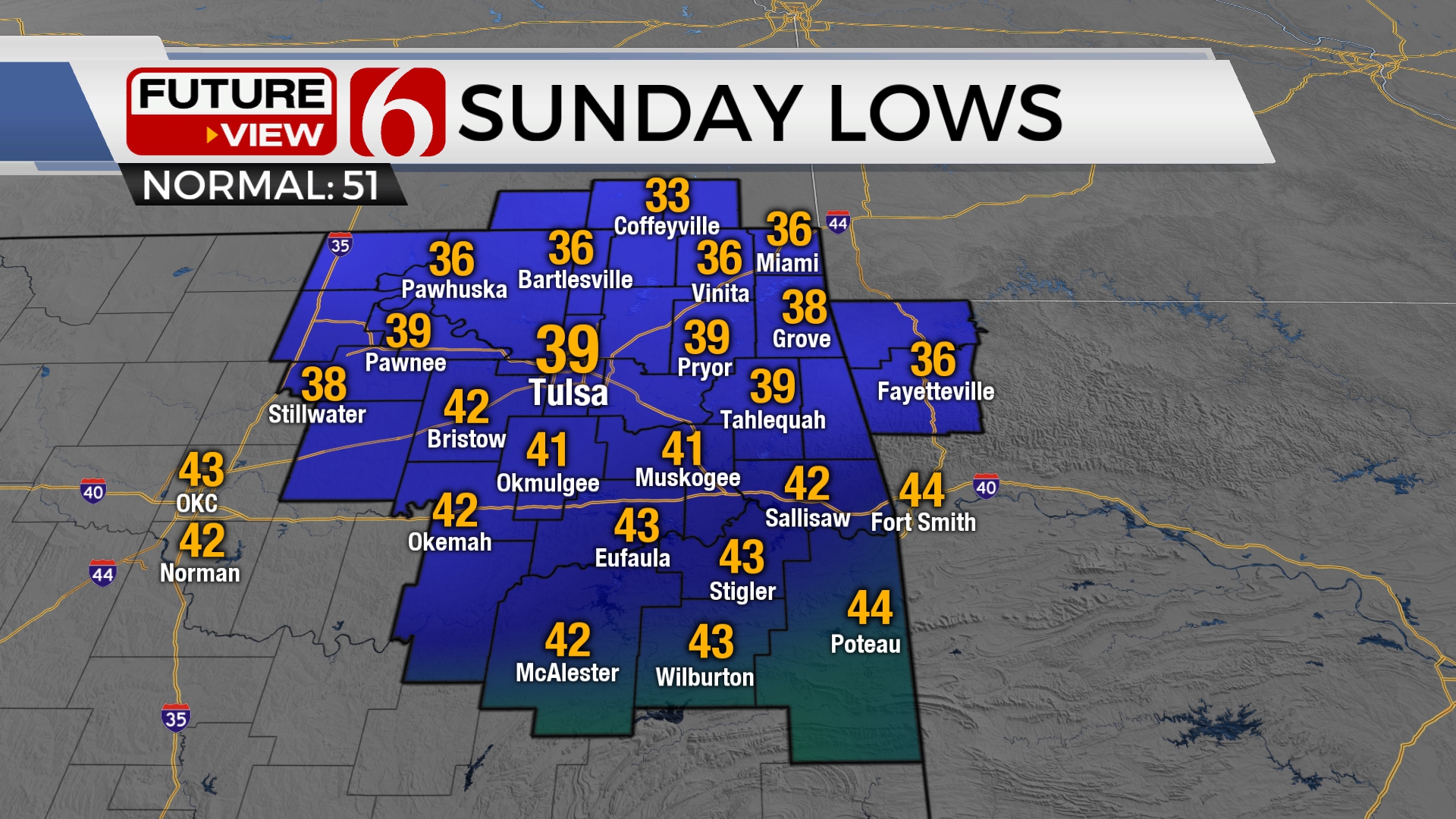
Sunday morning presents a myriad of small but important issues. A few spots across far northern OK into southern Kansas will be very close to freezing, while spots from the metro southward should stay in the upper 30s to lower

40s. Fewer clouds would get some spots near freezing in the valleys. At this point, we’ll keep it above freezing. Sunday midday to afternoon, another wave is scheduled to drop from the high plains of Texas into the Red River Valley. This will generate showers and possibly a rumble of thunder across western OK into the southern OK region. Most will remain south of the Metro through the day, but locations across highway 270 in southeastern OK may see a shower or two by Sunday evening.
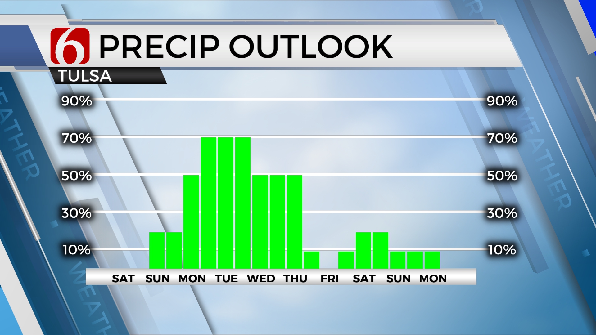
Finally early next week another western to middle U.S. trough influences the southern half of the plains with increasing rain and thunder chances. Some differences in the data remain regarding the exact position of a warm front that would separate the potential between severe weather locations. At this point, it appears the warm sector of the system may remain along the Red River southward into Texas for early next week. We’ll keep decent rainfall chances beginning Monday and lasting through Thursday. This period of time supports temperatures well below seasonal averages creating some rather chilly daytime highs with periods of rain early next week.
Thanks for reading the Friday morning weather discussion and blog.
Have a super great day!
Alan Crone
KOTV

Get The Daily Update!
Be among the first to get breaking news, weather, and general news updates from News on 6 delivered right to your inbox!
More Like This
April 21st, 2023

July 14th, 2023
March 31st, 2023
December 22nd, 2022
Top Headlines

December 14th, 2024

December 14th, 2024

December 14th, 2024

December 14th, 2024