Cool Temperatures Hang Around After Early-Morning Showers
Scattered storms hang around for the morning hours on Wednesday.Thursday, March 9th 2023, 6:55 am
If you’re into podcasts or in a rush, check out my daily weather update. Search for NewsOn6 and ‘Weather Out The Door’ on most podcast providers, including Spotify, Stitcher and Tune-In, or Click Here to listen on Apple Podcasts.
TULSA, Okla. - Scattered storms hang around for the morning hours on Wednesday.
Here are the details from News On 6 Meteorologist Alan Crone:
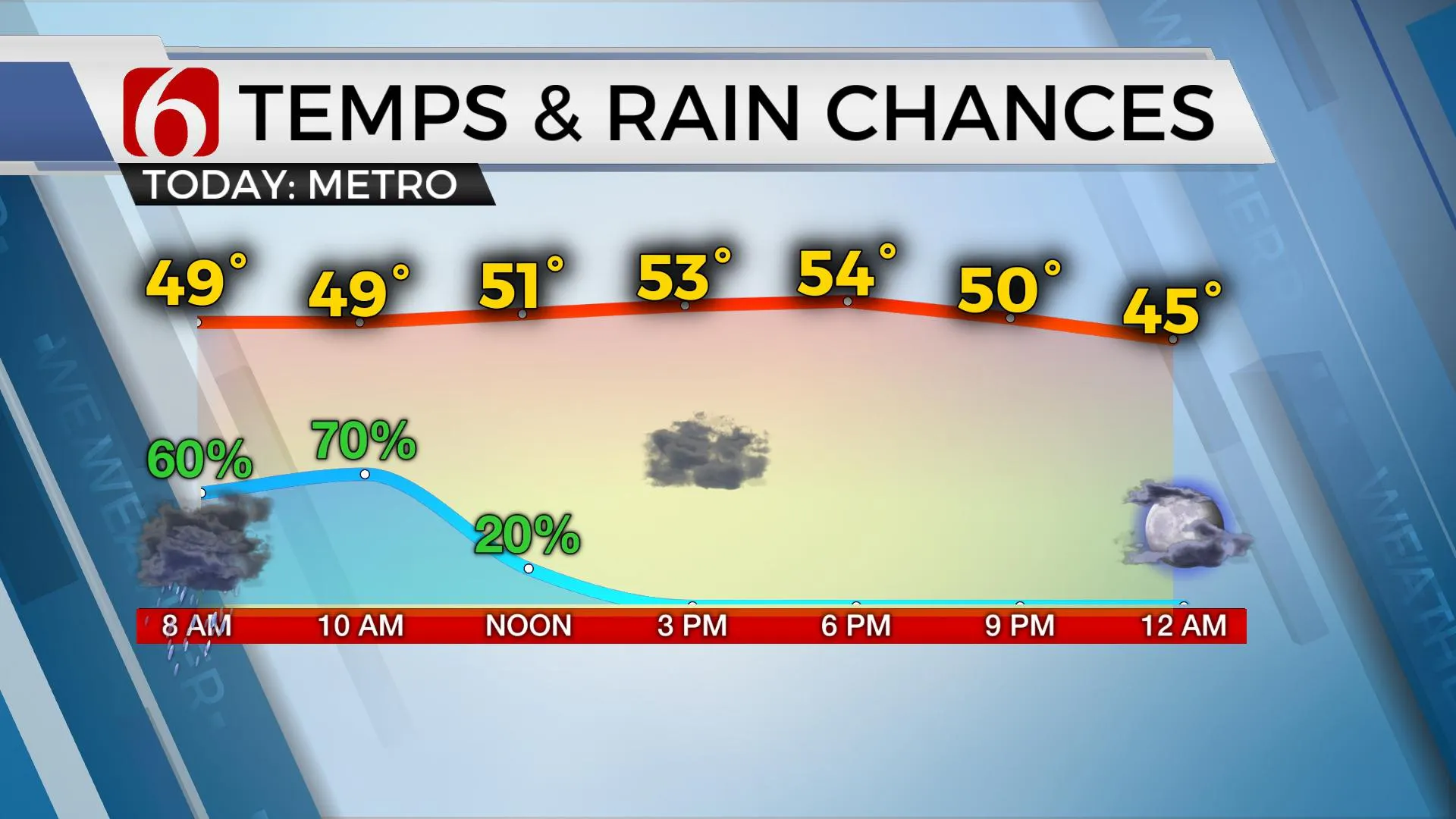
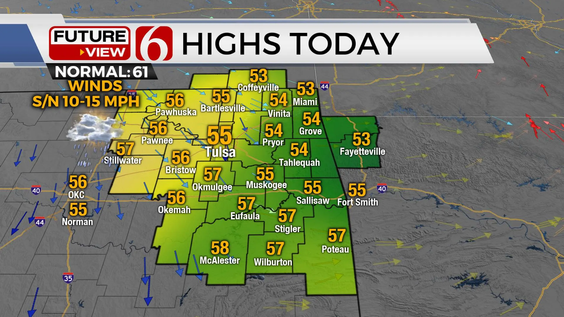
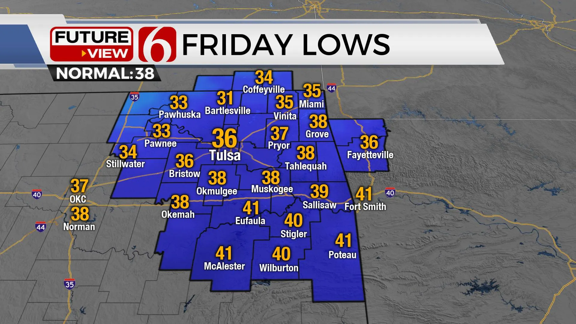
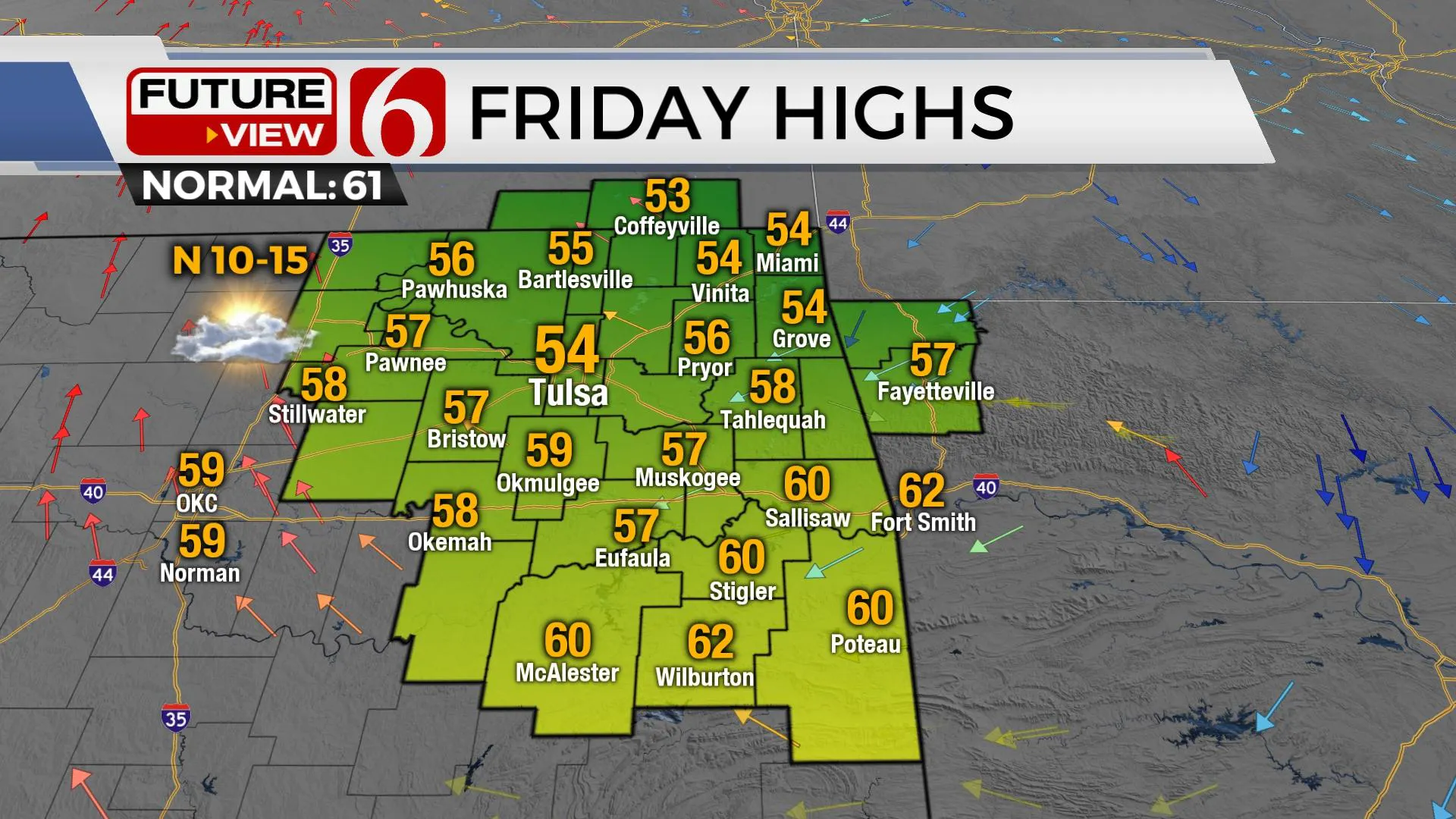
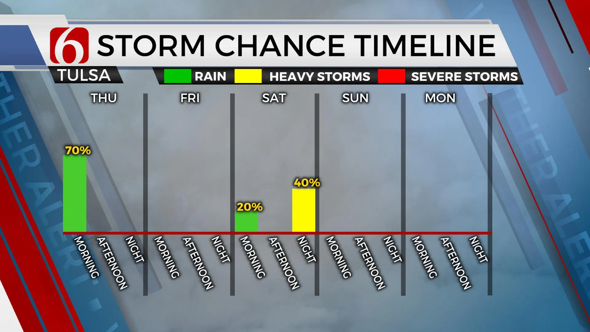
Showers and storms will move out of the area around noon as the main upper-level trough also exits the central plains later Thursday afternoon. The system seems to be a little slower in exiting compared to Wednesday’s data. This will result in keeping cloud cover longer through the day and keeping daytime highs in the 50s. Northwest winds from 10 to 15 mph will be likely by afternoon. A surge of slightly cooler air arrives tonight bringing temps down into the 30s Friday morning with afternoon highs staying in the mid-50s along with a sunshine-cloud mix. The next storm system quickly influences the area this weekend with a fast-developing surface low bringing a chance for additional thunderstorms across part of the area. Surface instability should be slightly higher compared to our current system and a higher chance for strong and severe storms will be possible. As the system exits the area late Saturday night and early Sunday morning, cooler weather returns Sunday lasting for a few days early next week. Another storm system should influence our area for the latter half of next week with a noted warming trend Wednesday before the system arrives.
Some pockets of moderate to heavy rainfall occurred again Wednesday night along and north of Highway 270 and south of I-44. We did have a few cells producing some hail, but this was along the Red River Valley. The main threat for the remainder of the early morning hours will be these pockets of moderate to heavy downpours along the I-40 corridor resulting in increasing water levels of streams, creeks, and low-water crossing areas that may also be problematic for the next few hours before improving midday to afternoon.
Spotty showers remain in the forecast for the metro region through the morning to midday hours. Most of the measurable precipitation should end around noon, but a few areas of mist may remain early Thursday afternoon with highs in the 50s. As the trough clears later Thursday night, this brings a clearing sky and cooler weather into early Friday.
The weekend system could provide a few showers and storms early to midday Saturday across far northern Oklahoma and southeastern Kansas as a lead wave ejects across this area. But our main window for strong to severe storms will arrive Saturday evening. A surface area of low pressure develops across the high plains of Texas and should drop along the Red River Valley. A dry-line feature is likely to sharpen around I-35 with a warm front attempting to form along the Red River. As the warm front lifts north Saturday evening, a few storms will attempt to develop but a layer of warm air aloft will suppress some activity. Any storms that do develop along or south of the warm front (Southeastern OK and northeast TX) would support all modes of severe weather. Storms developing to the north of the warm front may be more elevated and produce mostly hail as the main threat. Most of the scattered storm activity would be late Saturday evening into pre-dawn Sunday. As the surface low moves away from the area, cooler air arrives for Sunday and Monday prompting the possibility of some morning lows near freezing Monday and Tuesday morning. Below normal highs are expected Sunday and Monday with a warming trend Tuesday and Wednesday afternoons before the next cold front arrives around Thursday of next week.
Thanks for reading the Thursday morning weather discussion and blog.
Have a super great day!
Alan Crone
KOTV
More Like This
March 9th, 2023
July 3rd, 2023
June 8th, 2023
June 6th, 2023
Top Headlines
December 13th, 2024
December 13th, 2024
December 13th, 2024
December 13th, 2024


